Coastline stability, Cainozoic of north-east Scotland
From: Merritt, J W, Auton, C A, Connell, E R, Hall, A M, and Peacock, J D. 2003. Cainozoic geology and landscape evolution of north-east Scotland. Memoir of the British Geological Survey, sheets 66E, 67, 76E, 77, 86E, 87W, 87E, 95, 96W, 96E and 97 (Scotland).
Coastline stability
The present and future stability of any coastline depends on its geological context, supply of sediment, energy environment (wave, tide and wind) and the altitude at which this energy is delivered (sea level), together with any secondary effects resulting from human interference.
Much of the coastal edge of north-east Scotland is composed of hard rock cliffs that are highly stable in the short term at least. On the east coast, cliffs of resistant Old Red Sandstone sedimentary rocks and Dalradian metamorphic rocks extend from Inverbervie to Aberdeen, beyond which they give way to a low, sandy coastline backed by dunes between Aberdeen Bay and the Sands of Forvie. To the north of Cruden Bay the cliffs are composed of Peterhead Granite. The north coast is characterised by extensive cliffs formed of resistant Dalradian rocks, broken by a lower, sandy and rocky coastline at the Loch of Strathbeg and Rattray Head and by gravel beaches in Spey Bay, extending from Buckie to Lossiemouth. Permian sandstone cliffs between Lossiemouth and Burghead give way within Burghead Bay to gravel and sand beaches and spits that extend to Nairn and beyond. Elsewhere, on both coasts, beach development is restricted to small and stable cliff-foot bays. The cliffed sections of the coast are stable and hard, restricting the movement of the cliff-foot beaches that are consequently also stable. It is in the softer and low-lying sections of the coast that instability is an issue for planners and engineers.

Although tidal currents are relatively weak in the area, those along the eastern coast move southward and serve to reduce the northward wave-induced drift of sediment. However, a low net drift of sediment to the north still occurs (Hydraulics Research, 1997). Wave energies are highest close to Cairnbulg Point (NK 035 661) (P915374) and generally decline to the west and south (Natural Environment Research Council, 1998). As a result, Cairnbulg Point represents a sediment drift divide (Hydraulics Research, 1997), although sediment exchanges are restricted on the indented and cliffed sections of both coasts. On the north coast, in Spey and Burghead Bays to the west of Buckie, there is considerable wave-induced westerly longshore movement of sediment. Consequently, these stretches of coastline are affected by erosion in the east (up-drift) sections and by accretion in the west (down-drift). Elsewhere, the overall pattern of coastal sediment movement is locally affected where rivers carry high sediment loads into the sea. This occurs at and beyond the mouths of the Don, Ythan and Ugie; it is particularly, significant where the Spey enters the sea.


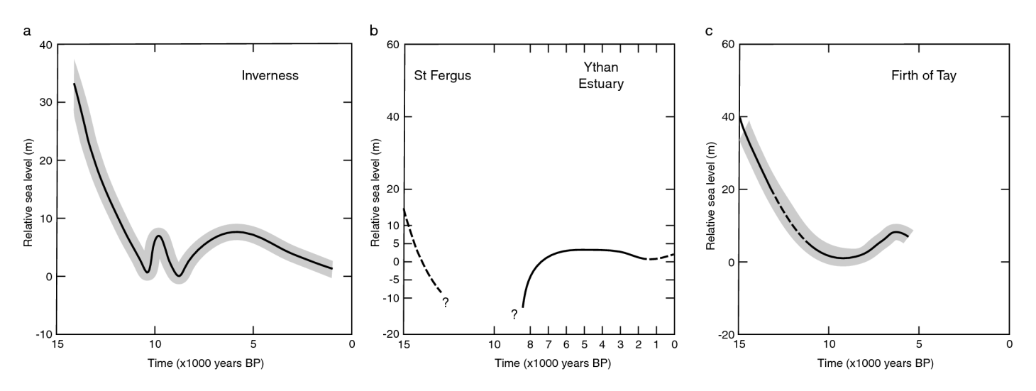
The history of sea level change is also important to coastal stability (Geomorphological features, P915295). The coast of the district has been subject to fluctuating sea level following deglaciation some 15–13 000 years ago, but about 7000 years ago a sea level rise culminated at about 8 m above OD, which allowed large quantities of glacigenic sediment to be moved onshore. This input of sediment is reflected in the impressive suites of raised beaches that are found in virtually all of the low lying coastal areas, but especially in the hinterlands of Spey Bay, Burghead Bay and backing the present-day beaches adjacent to Rattray Head and Forvie. The continuous isostatic rebound of the crust (P915296) to its present altitude led to the elevation of these beaches, but also to the reduction of the offshore supply of sediment that once fed them. In such conditions, beaches adjust to reduced sediment supply by internal reorganisation of sediments and by enhanced up-drift erosion to fuel down-drift accretion, a process that is evident at present in the eastern parts of Spey and Burghead Bays and in the southern part of Aberdeen Bay.
Present sea level change in the district is a combination of global rises in sea level and local crustal rise following deglaciation. Present crustal rise in north-east Scotland is about 0.5 mm per year (Shennan, 1989), although this increases to 1 mm per year around Nairn, while global sea level is rising at about 1–2 mm per year (Gornitz, 1995). Thus a small relative sea level rise appears to be under way in the east (Smith et al., 1999; see Site 9 Philorth Valley) while the west is in approximate balance. However, as global sea level is modelled to be subject to an accelerated rise of about 30 cm over the next 50 years (Hill et al., 1999), this state of approximate balance may be set to change. By 2050, the area may experience a relative sea level rise of 25–29 cm (Hill et al., 1999).
Placing sea-level changes into the context of present and future coastal stability, the low lying sand and gravel coasts are undergoing localised erosion at present. Where long-shore drift is significant, this is manifest by a tendency for erosion at one end of the beach to fuel deposition at the other. In the west, in embayments such as at Spey Bay and Burghead Bay, this erosion is associated with reduced levels of sediment supply and is possibly exacerbated by a slowly rising sea level. Where longshore drift is insignificant, such as at the Rattray Head beaches and at Balmedie, the shoreline is either stable or undergoing limited movement landwards by means of frontal erosion. In some places, close to towns and villages, the human response to this situation has been to defend the eroding sections of shoreline. If sea walls are used, such as at the south end of Aberdeen Bay, they commonly have the effect of further reducing the supply of sediment to the beaches and accelerating erosional responses elsewhere. As a result, the short and medium term future of such areas is either enhanced instability or the imposition of an artificial, constructed stability (in the form of a sea wall) which, in the long term, may be unsustainable. Where beach recharge mechanisms are used, such as at the mouth of the Spey, the short and medium term future is for the maintenance of ongoing natural coastal processes under an assured sediment supply regime, and, is consequently more sustainable in the long term (Gemmell et al., 1996).
By the year 2050 there may also be problems of coastal flooding of low-lying land as a result of the projected 25–29 cm sea level rise. Areas most at risk from future flooding are low-lying ground especially that in the east of the district and ground adjacent to river exits, whose flood waters may exacerbate any marine effect. Flooding of the lower parts of Aberdeen, together with the lower parts of coastal towns such as Banff could be experienced (Barne et al., 1996). On the other hand, a rising sea level will enhance the tendency for estuaries and inlets to infill from landward sediment sources and places such as the exits of the rivers Lossie, Deveron, Ugie, Ythan, Don and Dee may experience not only rapid infilling, but also a higher flood frequency.