File:P915412.png

Size of this preview: 800 × 491 pixels. Other resolution: 1,400 × 859 pixels.
Original file (1,400 × 859 pixels, file size: 371 KB, MIME type: image/png)
Summary
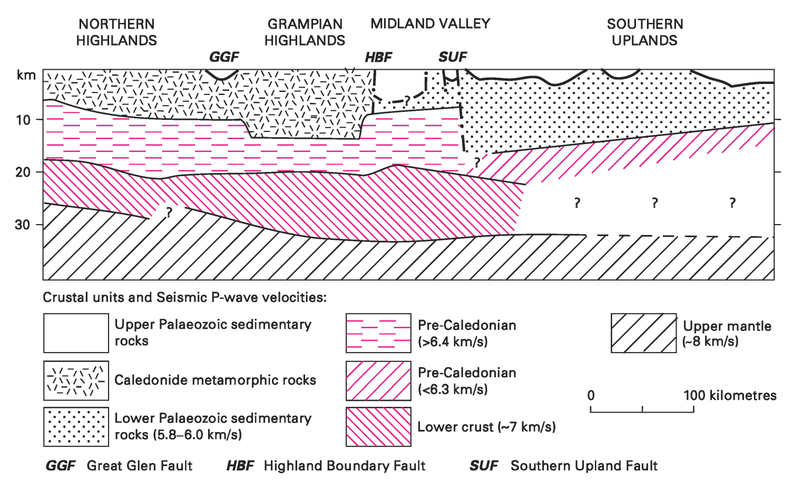
| description | English: Schematic cross-section through the crust and uppermost mantle of northern Britain (modified after Bamford, 1979). From: Figure 4 in Stephenson, D, and Gould, D. 1995. British regional geology: Grampian Highlands. Fourth edition. Keyworth, Nottingham: British Geological Survey. |
| source | BGS Copyright |
| author | BGS Copyright |
Licencing
{{subst:Custom license marker added by UW}} BGS Copyright
File history
Click on a date/time to view the file as it appeared at that time.
| Date/Time | Thumbnail | Dimensions | User | Comment | |
|---|---|---|---|---|---|
| current | 18:22, 10 July 2015 | | 1,400 × 859 (371 KB) | Scotfot (talk | contribs) | User created page with UploadWizard |
You cannot overwrite this file.
File usage
The following page uses this file: