Hydrogeology of Cote d'Ivoire
Africa Groundwater Atlas >> Hydrogeology by country >> Hydrogeology of Côte d'Ivoire
Most of the textual information on this page was taken from the chapter on Côte d'Ivoire in the report ‘Groundwater in North and West Africa’ (UN 1988). This information is outdated. If you have more recent information on the hydrogeology of Cote d'Ivoire, please get in touch.
Compilers
Dr Kirsty Upton and Brighid Ó Dochartaigh, British Geological Survey, UK
Geographical Setting
Côte d'Ivoire is in west Africa with a southern coast on the Gulf of Guinea. The country is largely flat, less than 500 m, with local relief. The west of the country is more hilly, with parts rising above 500 m, to a maximum of about 1200 m elevation. The south has many low lying areas and a few isolated or groups of low hills rising to around 650 m elevation.

General
| Estimated Population in 2013* | 20,316,086 |
| Rural Population (% of total) (2013)* | 47.2% |
| Total Surface Area* | 318,000 sq km |
| Agricultural Land (% of total area) (2012)* | 64.8% |
| Capital City | Yamoussoukro |
| Region | Western Africa |
| Border Countries | Liberia, Guinea, Mali, Burkina Faso, Ghana |
| Annual Freshwater Withdrawal (2013)* | 1549 Million cubic metres |
| Annual Freshwater Withdrawal for Agriculture (2013)* | 38.4% |
| Annual Freshwater Withdrawal for Domestic Use (2013)* | 41.1% |
| Annual Freshwater Withdrawal for Industry (2013)* | 20.5% |
| Rural Population with Access to Improved Water Source (2012)* | 67.8% |
| Urban Population with Access to Improved Water Source (2012)* | 91.5% |
* Source: World Bank
Climate
The southern coastal zone has an equatorial climate with the highest rainfall, at around 2,400 mm/year, and rainfall is fairly evenly distributed throughout the year. The centre of the country has a tropical climate, with average annual rainfall of around 1,000 to 1,400 mm, and two wet seasons: the main one starting in December and the smaller one from August to October. The north is drier, with average annual rainfall betweewn 400 and 1,000 mm, concentrated in a short rainy season from July to September.
-
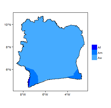
Koppen Geiger Climate Zones
-

Average Annual Precipitation
-

Average Temperature


For further detail on the climate datasets used see the climate resources section.
Surface water
|
|
 |
Soil
 |
Land cover
|
Equatorial tropical Forest savannah |
Geology
This section provides a summary of the geology of Côte d'Ivoire. More information is available in the report [ADD LINK UN] (1988) (see References section, below).
The geology map shows a simplified version of the geology at a national scale (see the Geology resources page for more details).

| Key Formations | Period | Lithology | |
| Geological Environment 1 | |||
|---|---|---|---|
| Name of formation1 | Time period | Description | |
| Geological Environment 2 | |||
| Geological Environment 3 | |||
Hydrogeology
This section provides a summary of the hydrogeology of the main aquifers in Côte d'Ivoire. More information is available in the report [ADD LINK UN] (1988) (see References section, below).
The hydrogeology map shows a simplified version of the type and productivity of the main aquifers at a national scale (see the Aquifer properties resource page for more details).


Unconsolidated
| Named Aquifers | Period | General Description | Water quality |
Sedimentary - Intergranular Flow
| Named Aquifers | Period | General Description | Water quality |
Sedimentary - Intergranular & Fracture Flow
| Named Aquifers | Period | General Description | Water quality |
Sedimentary - Fracture Flow
| Named Aquifers | Period | General Description | Water quality |
Basement
| Named Aquifers | Period | General Description | Water quality |
Groundwater Status
Groundwater quantity
Groundwater quality
Groundwater use and management
Groundwater use
Groundwater management
Groundwater monitoring
Transboundary aquifers
For further information about transboundary aquifers, please see the Transboundary aquifers resources page
References
The following references provide more information on the geology and hydrogeology of Cote d'Ivoire.
These, and others, can be accessed through the Africa Groundwater Literature Archive
United Nations. 1988. Groundwater in North and West Africa: Côte d'Ivoire. United Nations Department of Technical Cooperation for Development and Economic Commission for Africa, Natural Resources/Water Series No.18, ST/TCD/5
Return to the index pages
Africa Groundwater Atlas >> Hydrogeology by country >> Hydrogeology of Cote d'Ivoire