Kilchrist, Skye - an excursion: Difference between revisions
No edit summary |
No edit summary |
(No difference)
| |
Latest revision as of 16:04, 2 February 2018
| From: Bell, B.R. and Harris, J.W. An excursion guide to the geology of the Isle of Skye : Geological Society of Glasgow, 1986. © 1986 B.R. Bell & J.W. Harris. All rights reserved. October 2022 note: A new edition of the guide is now available. |


Excursion 5 Kilchrist (Figure 19a), (Figure 19b), (Figure 19c)
Purpose: To examine pyroclastic rocks of the Central Complex and their inter-relationships.
Aspects covered: pyroclastic deposits of the Kilchrist area; the Kilchrist Hybrid Ring-dyke (mixed-magma intrusion); a rhyolite breccia; a rhyolite sheet; ignimbrites; the Inner Granite of the Eastern Red Hills Centre (coarse- and fine-grained facies); Cambro-Ordovician carbonates and Jurassic shales in a fault contact.
Route: Cill Chriosd Churchyard–Broadford River–Allt Coire Forsaidh–Coire Forsaidh–Allt Cnoc nan Uan–Allt nan Suidheachan–Allt Slapin–Torrin–(Cill Chriosd Churchyard).
Distance: 12 kilometres.
Time: 8 hours.
General comments: This excursion depends upon the crossing of a small concrete weir over the Broadford River. In exceptionally wet conditions this may not be possible. For non coach parties the starting and finishing points are 5km (3 miles) apart. For coach parties, however, a convenient pick-up and turning point is the entrance of the marble quarry on the east side of Torrin [NG 5822 2032], 4km (2.5 miles) west of the starting point of the excursion, on the Broadford-Elgol (A881) road.
Loch Cill Chriosd (Kilchrist) is on the north side of the Broadford-Elgol (A881) road, 5km (3 miles) SW of Broadford. Parking for 6 cars, 3 minibuses or 2 coaches (but see General Comments, above) is available opposite the Cill Chriosd Churchyard on the south side of the road.
Locality 1 [NG 6172 2068]
From the churchyard walk a few metres SW along the road and gain access to the lochside via a gate. Proceed through the gate towards the NE end of Loch Cill Chriosd. From this locality, the field relationships of several of the components of the Eastern Red Hills Centre (7A) may be identified readily. The most obvious feature is the Inner Granite (7G), 2km to the NW and forming the three red hill summits of Beinn na Caillich, Beinn Dearg Mhor (not visible from here) and Beinn Dearg Bheag. South of the Inner Granite (due west of the present locality) are the pyroclastic rocks of the Kilchrist area (8D, 8E), which form the bulk of the hummocky ground as far west as the village of Torrin (a distance of 4km). North of Loch Cill Chriosd, the eastern limb of the Kilchrist Hybrid Ring-dyke (7B) forms the curved ridge running north over Creagan Fitheach. To the SW, the ridge of Beinn an Dubhaich marks the southern outcrop of the Outer Granite (7F), which is intruded into, and has thermally metamorphosed, Cambro-Ordovician carbonates (2D, 71). Due east, Ben Suardal is composed of carbonates (the Ben Suardal Dolostones) of the Cambro-Ordovician sedimentary sequence (2D). In the immediate area the Ben Suardal Dolostones crop out and are cut by members of the Lower Tertiary regional dyke swarm (9B). The carbonates are well-bedded, show the development of a clint and gryke pavement, and have been mildly recrystallised by the subvolcanic granites of the district (70. Continue to the NE end of the loch and cross the Broadford River at the small concrete weir. Walk around the northern end of the loch, past a small mass of Cambro-Ordovician carbonates surrounded by agglomerates, until the Allt Coire Forsaidh is reached. Follow the river upstream for 200m until the first good exposures in the stream bed are reached, at the small waterfalls.
Locality 2 [NG 6098 2062]
In the stream bed of the Allt Coire Forsaidh the inner part of the Eastern intrusion of the Kilchrist Hybrid (mixed-magma) Ring-dyke (7B) may be examined. The rock has the appearance of a medium- to coarse-grained, dark granite. The hybrid nature of this rock is suggested by: (1) inclusions (up to 3cm) of fine-grained, basic material; (2) inclusions (up to 30cm) of coarse-grained, granitic material; (3) quartz xenocrysts fringed by clusters of amphibole and/or pyroxene; and, (4) alkali feldspar crystals showing signs of rounding due to magmatic corrosion. Further petrological details of this intrusion, together with possible mechanisms of formation, are presented in Section (B) of Chapter 7. Continue up the track between the forestry ground and the Allt Coire Forsaidh for a distance of 250m. The pyroclastic rocks preserved within the Kilchrist Ring-dyke crop out over most of the area west of this limb of the intrusion, but are only well-exposed in the stream bed.
Locality 3 [NG 6084 2084]
Exposed in the stream bed at the NW side of this broad bend in the Allt Coire Forsaidh is a dark red, lateritic horizon within the pyroclastic rock sequence (8D). It consists of lithic clasts (including basalt, tuff, gabbro and Jurassic siltstone and limestone) of lapilli-size, set in a tuffaceous matrix which is severely lateritised. This unit is at least 0.5m thick and has been interpreted as a Lower Tertiary sub-aerial weathering surface. Above are normal, chaotic agglomerates. Follow the agglomerates in the Allt Coire Forsaidh to the SE side of the Coire Forsaidh. 100m SE of the large waterfall is a white scar on the steep east bank of the river, marking the outcrop of a rhyolite breccia.
Locality 4 [NG 6030 2124]
This rhyolite breccia is exposed on the east bank of the river, as well as in the stream bed. It is described in Section (0) of Chapter 9. Poor exposure makes the interpretation of this mass of rock difficult. For example, it is not possible to be sure whether it is intrusive or extrusive. From its apparent bulbous form, it is concluded that within the agglomerates a rhyolite dome is preserved, which formed by the partial extrusion of rhyolitic magma onto the Lower Tertiary land surface. The rapidly-cooled outer surface spalled to give rise to the mass of brecciated material now preserved. The face of the large waterfall at the back of the corrie is composed of the Coire Forsaidh intrusion of the Kilchrist suite of hybrids (7B). This intrusion is also exposed in the nearby western tributary of the Allt Coire Forsaidh, 25m up from the confluence, just before (east of) a 5m-high waterfall, where it shows the development of a marginal, flow-banded facies. This facies of the intrusion consists of sub-centimetre -thick bands which have been highly contorted during intrusion of the hybrid magma. This material is well-exposed on the north bank of the tributary and in the stream bed. Leave the tributary of the Allt Coire Forsaidh and, staying at the same height (O.D.), walk SW for 500m to the upper reaches of the Allt Cnoc nan Uan, where this river cuts a distinct gash in the pyroclastic rocks.
Locality 5 [NG 6000 2088]
The steep-sided upper reaches of the Allt Cnoc nan Uan have a straight NW-SE trend which is controlled by steeply-dipping slabs of pyroclastic material and an acid sheet which have been preferentially eroded. The most obvious unit is a highly-altered rhyolite sheet (on the west bank) which dips to the west at an angle of between 70 and 75°. This 3m-thick rhyolite crops out at the top of the gully (below where the hill opens out into a plateau region) and is associated with highly-altered, concordant tuffs and sediments which are exposed in the stream bed. Agglomerates form the east bank of the river. Walk 400m WSW to the Allt nan Suidheachan, on the far side of the crags at 150m O.D.
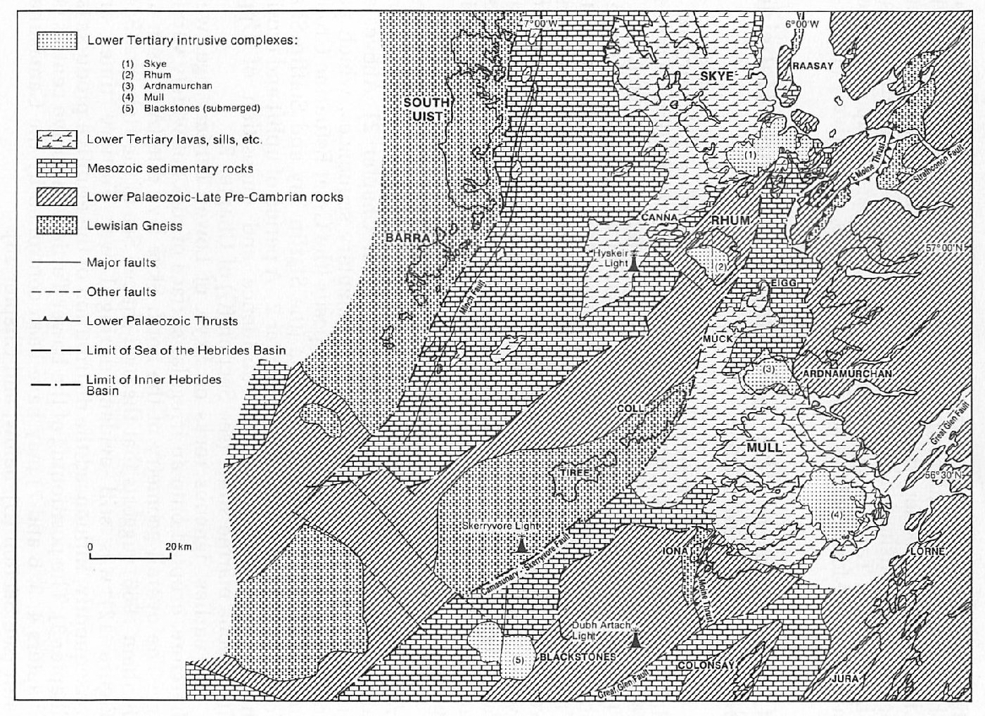
Between Localities 5 and 6, particularly on the crags east of the Allt nan Suidheachan, regional observations can be made. First, the Strath Suardal, from Loch Cill Chriosd west to Torrin, is composed of Cambro-Ordovician carbonates (Ben Suardal Dolostones), giving rise to a characteristic lush green vegetation. The higher ground of Beinn an Dubhaich, on the south side of the valley, is composed of granite. The quarry at Kilbride is within thermally-metamorphosed Cambro-Ordovician carbonates (marbles) which occur as a roof pendant above the granite. The bulk of the material extracted is used either as aggregate or as a source of agricultural lime. Second, the peninsula of Strathaird is built of Middle to Upper Jurassic strata (2F), on the low-lying ground, capped by Lower Tertiary plateau lavas (3D), typified by the summits of Ben Meabost in the south and An Carnach in the north. Note particularly the lavas of An Stac, disrupted upwards close to the eastern margin of the Cuillin Complex (4A) which crops out on Blaven. Beyond Strathaird, to the south, is the Lower Tertiary igneous complex of Rhum (Figure 12) and (Figure 13).
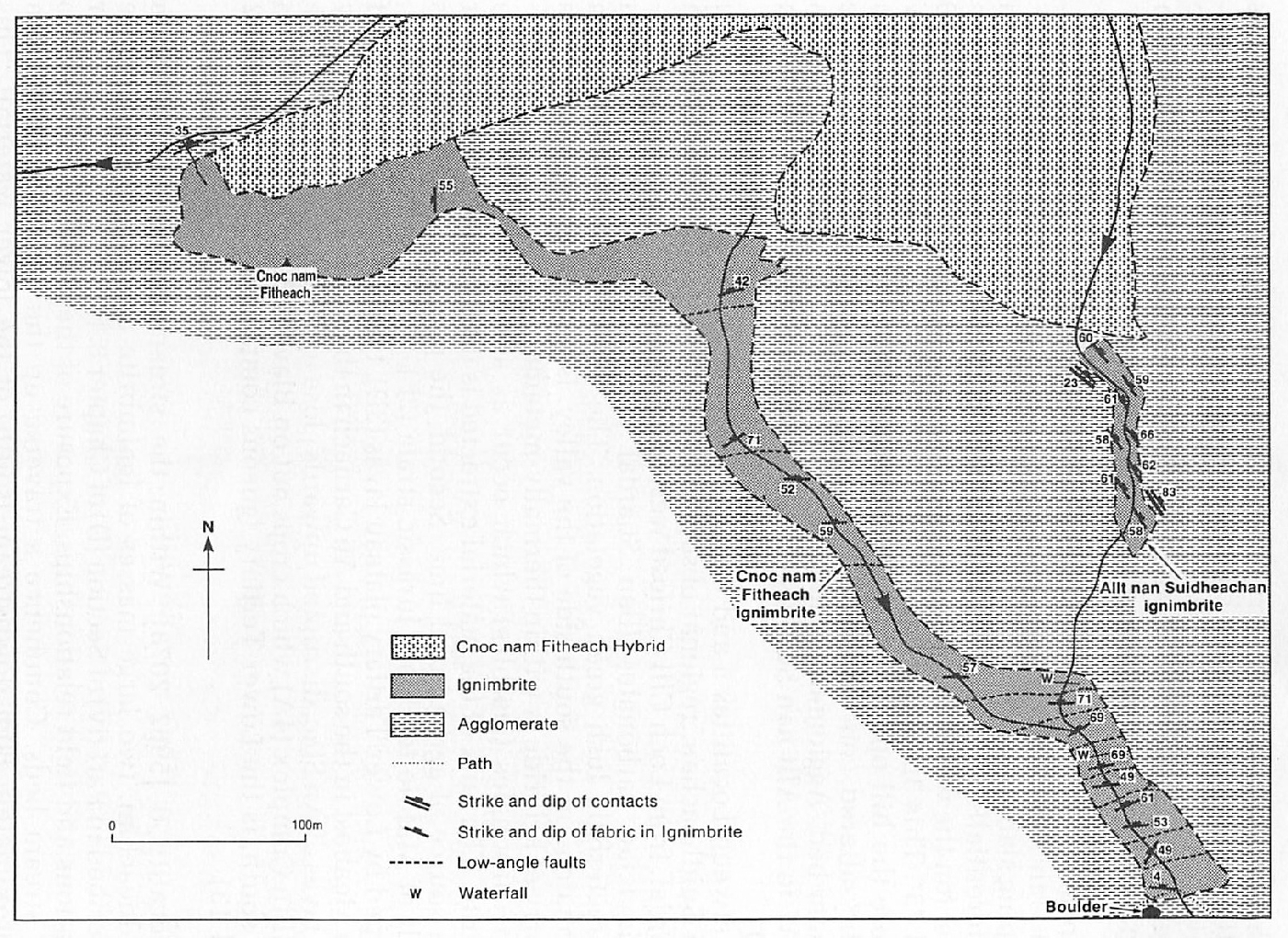
Locality 6 [NG 5962 2078]
Within the stream bed of the Allt nan Suidheachan, two large masses of ignimbrite are exposed. These are described in Part (iv) of Section (D) of Chapter 8. (Figure 19b) shows their locations and field relationships. Exposure of these rocks is confined to the stream beds. Commence a traverse up the stream section from approximately 80m downstream (south) of the lower waterfall. This point can be located by a large boulder on the west bank, where an indistinct path crosses the stream. Features which should be noted include:
- The conformable relationship between the Cnoc nam Fitheach ignimbrite and the underlying lapilli-tuff, at the southern end of the outcrop
- The slump structures at the top of the Cnoc nam Fitheach ignimbrite, at the base of the higher (more northerly) waterfall
- The very high aspect ratios of the fiamme within both ignimbrite masses
The Cnoc nam Fitheach intrusion of the Kilchrist suite of hybrids (7B) crops out north of the agglomerate which forms the crags of Cnoc nam Fitheach. Leave the Allt nan Suidheachan and walk WNW over the poorly-exposed agglomerates of the district to the steep-sided gorge of the Allt Slapin (a distance of approximately 1.5km), at the margin of the Inner Granite (7G), marked by a distinct break in slope at approximately 200m O.D.
Locality 7 [NG 5842 2178]
Parallel to the boundary of the Inner Granite (7G), the Alt Slapin has cut a deep gully which allows a detailed examination of the marginal facies of the intrusion and its contact relationships with various acid breccias (90). These relationships are illustrated in (Figure 19c) and are described in Section (0) of Chapter 9. The marginal, chill facies of the granite is dark green and contains microphenocrysts of quartz and alkali feldspar. This grades inwards, over 1–2m, into the more common buff-coloured, coarse-grained facies of the intrusion (7G). The transition may be traced within the stream bed of the Allt Slapin. From the Allt Slapin proceed WSW to the StrollamusTorrin footpath and thence south towards Torrin. Due east of Cnoc Slapin, where the path crosses the Allt Slapin, a vertical, faulted contact between Cambro-Ordovician carbonates (2D) and Lower Jurassic sandstones and shales (2F) is marked by a 2m-wide zone of highly brecciated material, predominantly shale, in the form of disoriented blocks.
Continue SSW to the Broadford-Elgol (A881) road and thence SE either for 1km (0.6 miles) to the marble quarry entrance, or, 5km (3 miles) to the Cill Chriosd Churchyard.
References
Appendix 1: Glossary of petrological names and terms
Appendix 2: Glossary of fossil names
Appendix 3: Glossary of place names and grid references
| At all times follow: The Scottish Access Codeand Code of conduct for geological field work |