File:DalradianExcursion005.jpg
Jump to navigation
Jump to search
Size of this preview: 407 × 600 pixels. Other resolution: 950 × 1,400 pixels.
Original file (950 × 1,400 pixels, file size: 571 KB, MIME type: image/jpeg)
Summary
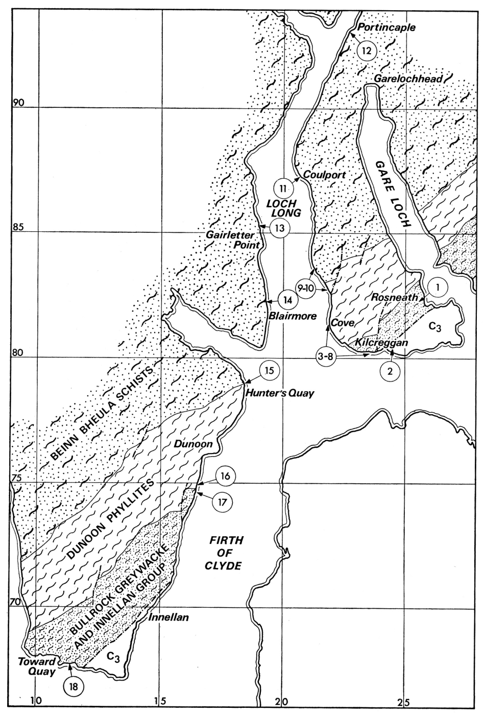
| description | English: Geological map of Rosneath and south-east Cowal (after sheets 29 (Rothesay) and 30 (Glasgow) of the Geological Survey of Scotland). See figure 1 of the introductory guide for the axial traces of the major folds recognized in this area. From: J. L. Roberts 1977. 1: The Rosneath and south-east Cowal. Scottish Journal of Geology v 13. p.101-111. |
| source | Dalradian rocks of the South-west Highlands. Scottish Journal of Geology 13 (2) 1977 |
| author | Edinburgh Geological Society |
Licensing
{{subst:Custom license marker added by UW}}
| This image is Copyright Edinburgh Geological Society. The images may be reproduced free of charge for any non-commercial use in any format or medium provided they are reproduced accurately and not used in a misleading or derogatory context. Where any images on this site are being republished or copied to others, the source of the material must be identified and the copyright status acknowledged. For all other uses of the images please contact the Edinburgh Geological Society. publications@edinburghgeolsoc.org |
File history
Click on a date/time to view the file as it appeared at that time.
| Date/Time | Thumbnail | Dimensions | User | Comment | |
|---|---|---|---|---|---|
| current | 21:49, 6 May 2015 | | 950 × 1,400 (571 KB) | Scotfot (talk | contribs) | User created page with UploadWizard |
You cannot overwrite this file.
File usage
The following page uses this file: