File:Lolworthcoveweb8a07.png
Jump to navigation
Jump to search
No higher resolution available.
Lolworthcoveweb8a07.png (600 × 424 pixels, file size: 151 KB, MIME type: image/png)
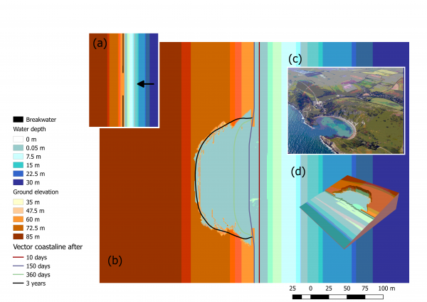
Simulated embayment creation on an initially rectilinear coastline using the Coastal Modeling Environment. (a) At the start of the simulation, all the coastline of a gently sloping topography is protected by a breakwater but a short segment in the centre that is un-protected. (b) Location of the vector coastline at different time steps and final topography after three years of simulation. © The resulting embayment is bounded by a cliff similar to the Lulworth Cove bay in the south of the UK.
File history
Click on a date/time to view the file as it appeared at that time.
| Date/Time | Thumbnail | Dimensions | User | Comment | |
|---|---|---|---|---|---|
| current | 14:22, 20 July 2023 | | 600 × 424 (151 KB) | Agarcia (talk | contribs) |
You cannot overwrite this file.
File usage
The following 2 pages use this file: