File list
Jump to navigation
Jump to search
This special page shows all uploaded files.
| Date | Name | Thumbnail | Size | User | Description | Versions |
|---|---|---|---|---|---|---|
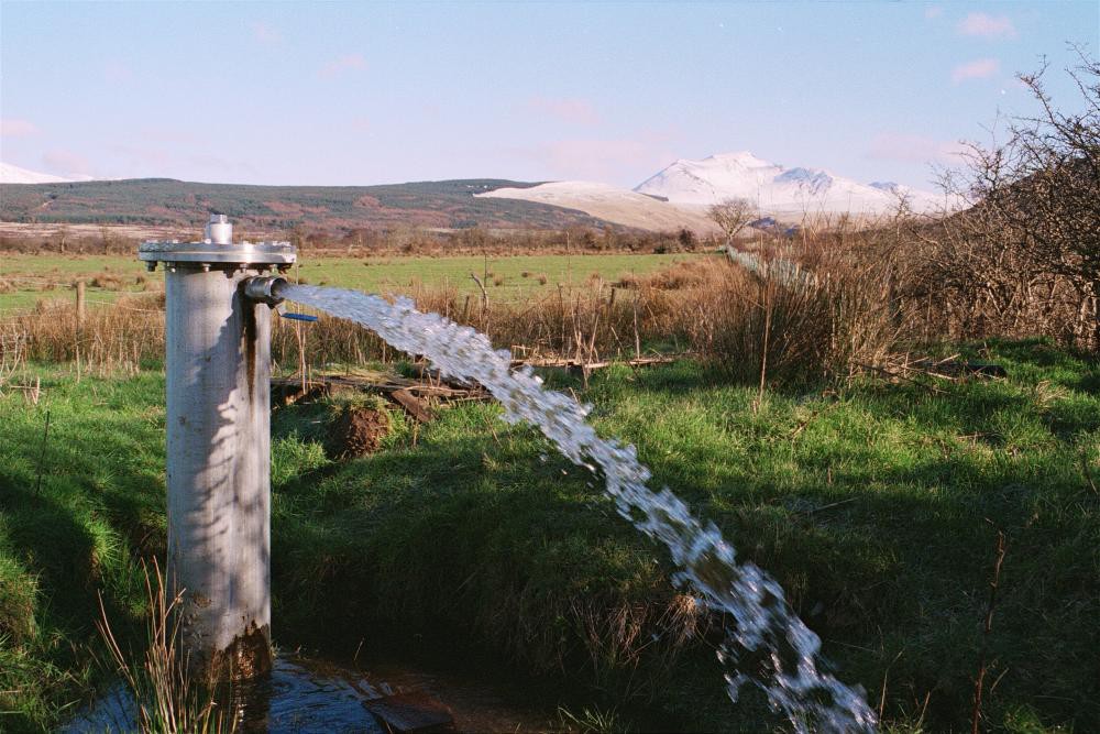
| 15:57, 19 May 2014 | P802428.jpg (file) |  |
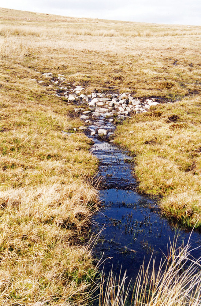
363 KB | Dbk | One of many springs flowing from boggy ground at the junction of the basal Namurian grit and the underlying Avon Group near Trefil, north of Tredegar . | 1 |
| 15:57, 19 May 2014 | P859273.jpg (file) |  |
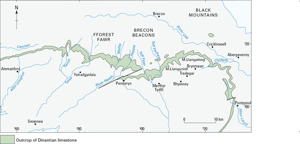
93 KB | Dbk | Sketch map of the Pembroke Limestone group outcrop along the North Crop (after Gasgoine, 1989). | 1 |
| 16:01, 19 May 2014 | P859290.jpg (file) |  |
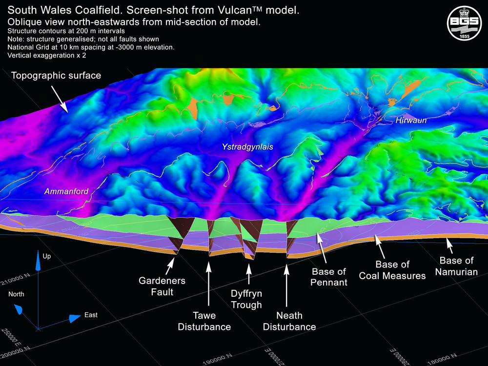
252 KB | Dbk | Oblique west–east screen shot from VULCAN model along national grid northing 200000 looking towards the north-west. | 1 |
| 16:03, 19 May 2014 | P859291.jpg (file) |  |
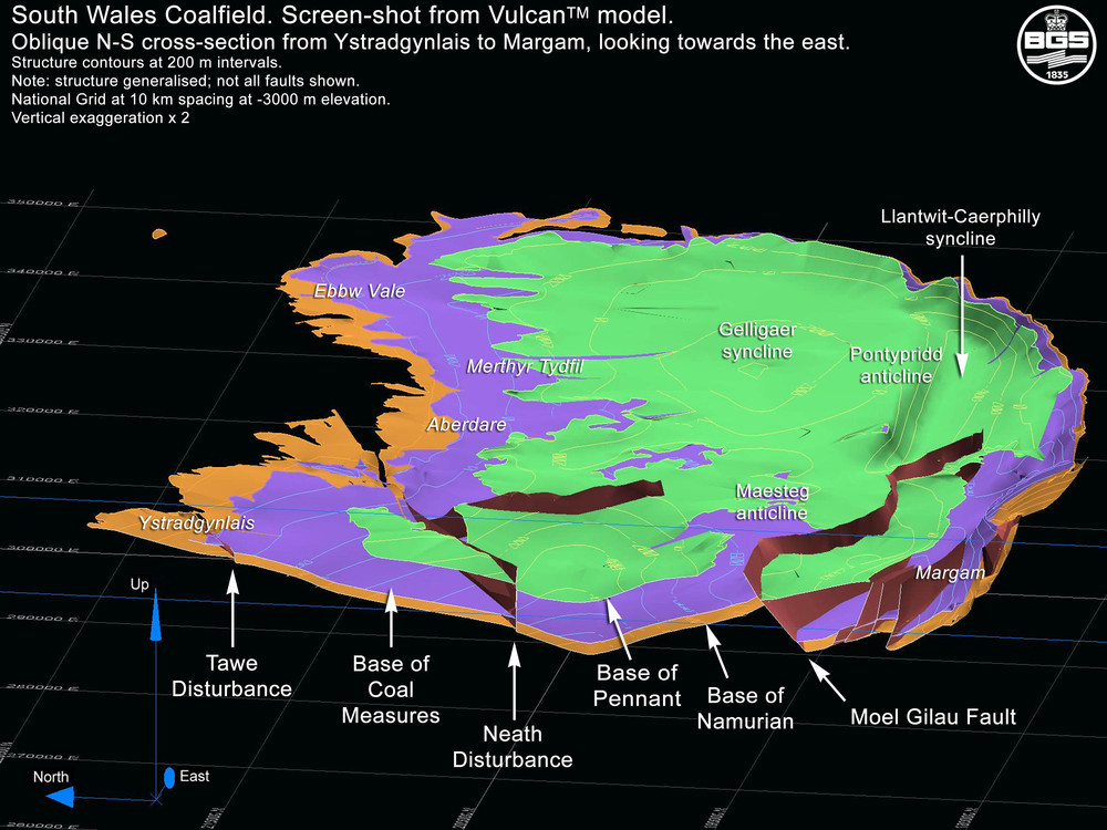
214 KB | Dbk | Screen shot showing an oblique north-south section through Margam looking west and illustrating the low angle Moel Gilau fault. | 1 |
| 16:04, 19 May 2014 | P859292.jpg (file) |  |
174 KB | Dbk | Screen shot showing the structure on the base of the South Wales Lower Coal Measures Formation with contours at 200 m intervals: dark purple -2500 m OD; green -1000 m OD; orange 0m OD. | 1 |
| 16:06, 19 May 2014 | P859274.jpg (file) |  |
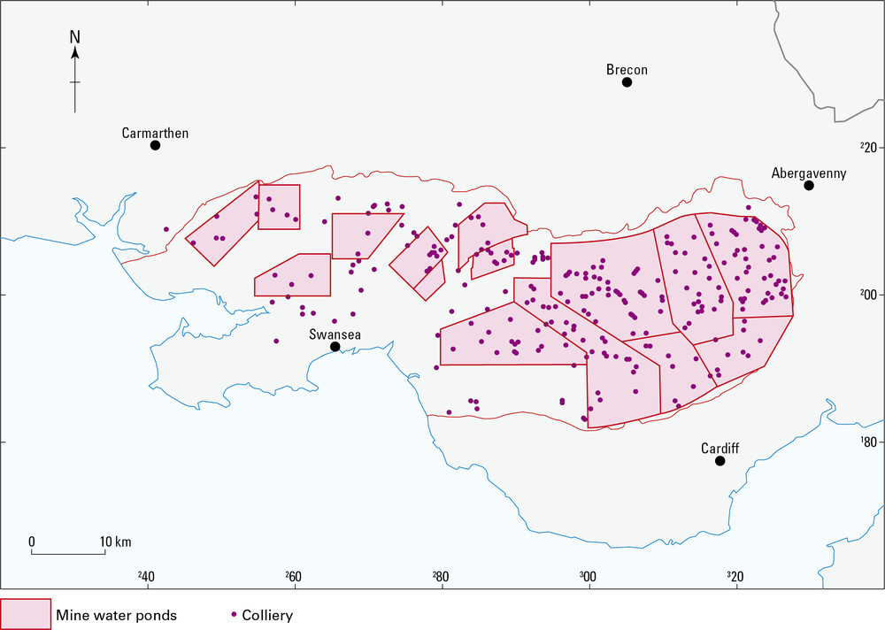
120 KB | Dbk | The discrete drainage ponds within the former operational South Wales Coalfield (after Lewis et al., 2000). | 1 |
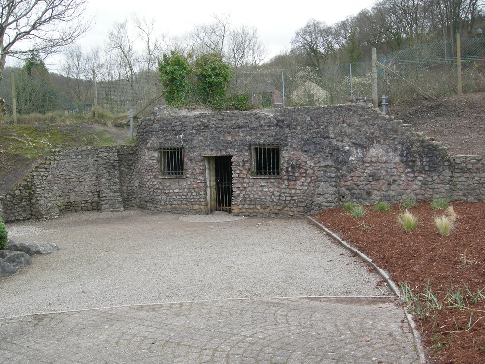
| 16:07, 19 May 2014 | P802426.jpg (file) |  |
314 KB | Dbk | Taff's Well - a warm spring rising from faulted Avon Group strata on the bank of the Taff, now housed in an enclosed bath. | 1 |
| 16:10, 19 May 2014 | P802424.jpg (file) |  |
169 KB | Dbk | The main shaft and buildings at Tower Colliery prior to closure in 2008. The dark green area is reclaimed opencast land and contrasts with the yellow-green natural vegetation in the foreground. | 1 |
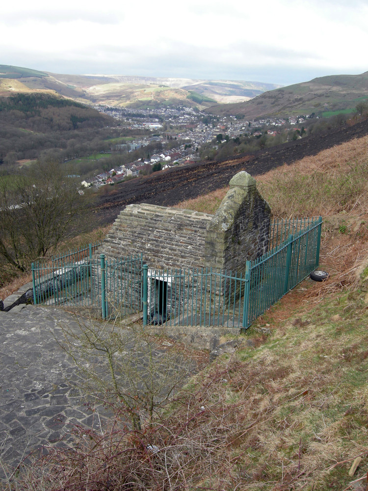
| 16:11, 19 May 2014 | P802425.jpg (file) |  |
336 KB | Dbk | St Mary's Well at Penrhys – a spring issuing from Pennant Sandstone on the side of the Rhondda Fach above Fernadale. | 1 |
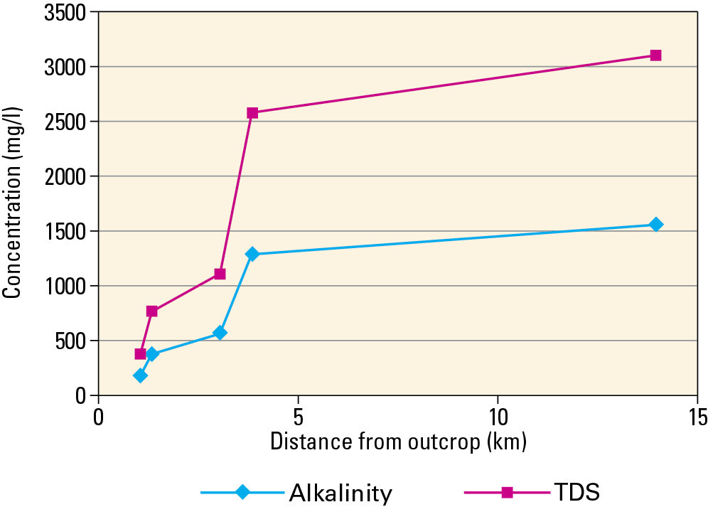
| 16:13, 19 May 2014 | P859275.jpg (file) |  |
75 KB | Dbk | Alkalinity and total dissolved solids evolution down dip in the Old Coal Horizon (after Ineson, 1967). | 1 |
| 16:14, 19 May 2014 | P859276.jpg (file) |  |
73 KB | Dbk | Piper diagram showing the distribution of the four main groundwater types in the South Wales Coal Measures Group (after Ineson, 1967). | 1 |
| 07:52, 20 May 2014 | P802430.jpg (file) |  |
252 KB | Dbk | Jurassic Lias limestone cliffs at Nash Point, South Glamorgan. | 1 |
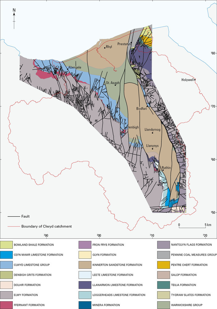
| 07:55, 20 May 2014 | P859277.jpg (file) |  |
160 KB | Dbk | Vale of Clwyd—geological setting. | 1 |
| 07:57, 20 May 2014 | P859278.jpg (file) |  |
139 KB | Dbk | The Vale of Clwyd Triassic aquifer (after ESI, 2003). | 1 |
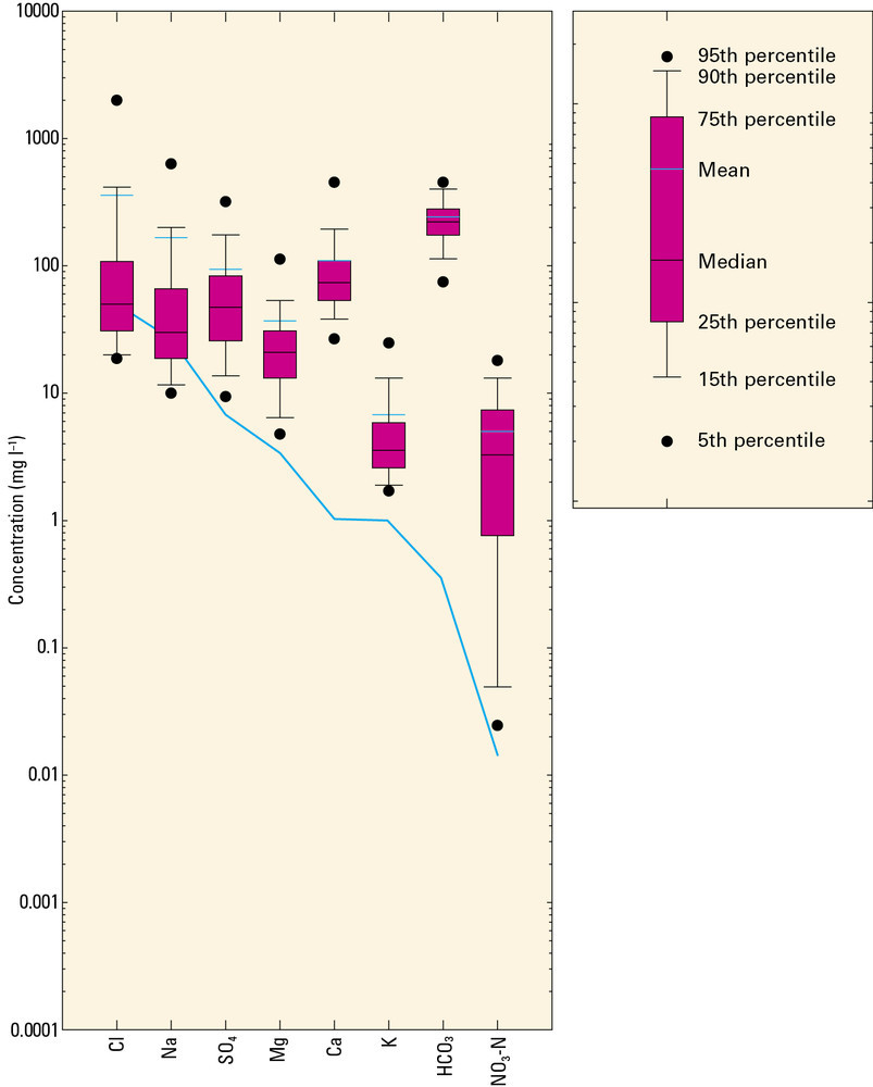
| 07:59, 20 May 2014 | P859279.jpg (file) |  |
78 KB | Dbk | Range of major ion concentrations in Permo-Triassic groundwaters in West Cheshire and Dee catchment (after Griffiths et al., 2002). | 1 |
| 08:01, 20 May 2014 | P802431.jpg (file) |  |
361 KB | Dbk | Triassic Blue Anchor Formation exposed in cliffs at St Mary's Well Bay, south of Penarth. | 1 |
| 08:03, 20 May 2014 | P802432.jpg (file) |  |
232 KB | Dbk | 1 | |
| 08:05, 20 May 2014 | P859280.jpg (file) |  |
157 KB | Dbk | Distribution of superficial deposits in Afon Teifi showing borehole well and spring locations (after Robins et al., 2000). | 1 |
| 08:06, 20 May 2014 | P859281.jpg (file) |  |
99 KB | Dbk | Schematic section of the central part of the Lower Afon Teifi showing the main flow components (after Robins et al., 2000). | 1 |
| 08:09, 20 May 2014 | P859282.jpg (file) |  |
252 KB | Dbk | Groundwater levels monitored by Dŵr Cymru in the gravel aquifer near Pilleth (after ESI, 2006). | 1 |
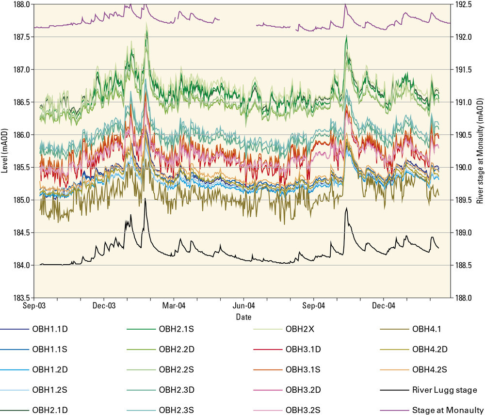
| 08:11, 20 May 2014 | P859283.jpg (file) |  |
82 KB | Dbk | Groundwater levels in Environment Agency observation boreholes in the Upper Lugg catchment (after ESI, 2006). | 1 |
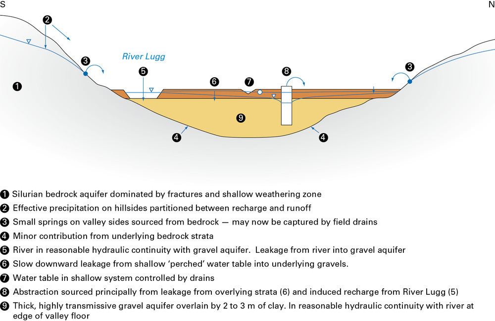
| 08:12, 20 May 2014 | P859284.jpg (file) |  |
120 KB | Dbk | Schematic conceptual model of the hydrogeology of the Upper Lugg catchment (after ESI, 2006). | 1 |
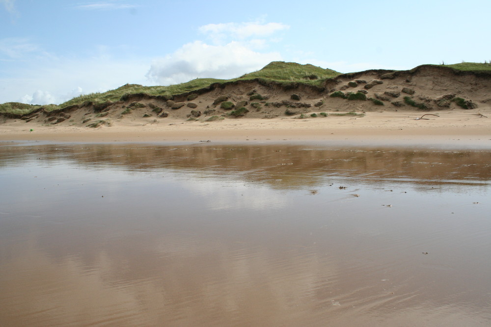
| 08:16, 20 May 2014 | P802434.jpg (file) |  |
109 KB | Dbk | Groundwater discharge along the foreshore beneath Whiteford Burrows on the Gower Peninsula. | 1 |
| 08:17, 20 May 2014 | P859285.jpg (file) |  |
65 KB | Dbk | Schematic cross section of the central foreshore at Whiteford Sands showing the steepening of the hydraulic gradient away from the dune front following storm damage in 1966. | 1 |
| 08:20, 20 May 2014 | P802433.jpg (file) |  |
272 KB | Dbk | Installing an automatic weather station at Newborough Warren, Anglesey. | 1 |
| 08:21, 20 May 2014 | P859286.jpg (file) |  |
148 KB | Dbk | Conceptual seasonal patterns of groundwater flow at Newborough Warren–upper winter, lower summer (blue–till; yellow–sand aquifer; brown bedrock ridge; blue arrows indicate likely groundwater flowpaths). | 1 |
| 08:23, 20 May 2014 | P859287.jpg (file) |  |
263 KB | Dbk | The abstraction licence exempt are (as at 2012). | 1 |
| 08:28, 20 May 2014 | P802437.jpg (file) |  |
184 KB | Dbk | The abandoned Parys Mountain copper mine seen in 2004, Anglesey. | 1 |
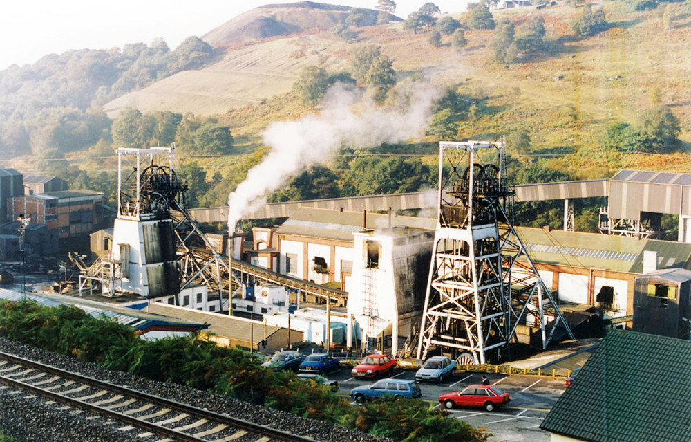
| 08:29, 20 May 2014 | P802438.jpg (file) |  |
303 KB | Dbk | Taff Merthyr Colliery prior to closure in 1992. | 1 |
| 08:29, 20 May 2014 | P802436.jpg (file) |  |
314 KB | Dbk | Ferruginous mine water discharged from Taff Merthyr Colliery shaft after closure. | 1 |
| 08:30, 20 May 2014 | P802435.jpg (file) |  |
330 KB | Dbk | Mine water from Taff Merthyr after treatment emerging from the reed bed treatment area. | 1 |
| 08:35, 20 May 2014 | P859289.jpg (file) |  |
177 KB | Dbk | Location of the present-day groundwater level and quality monitoring networks. | 1 |
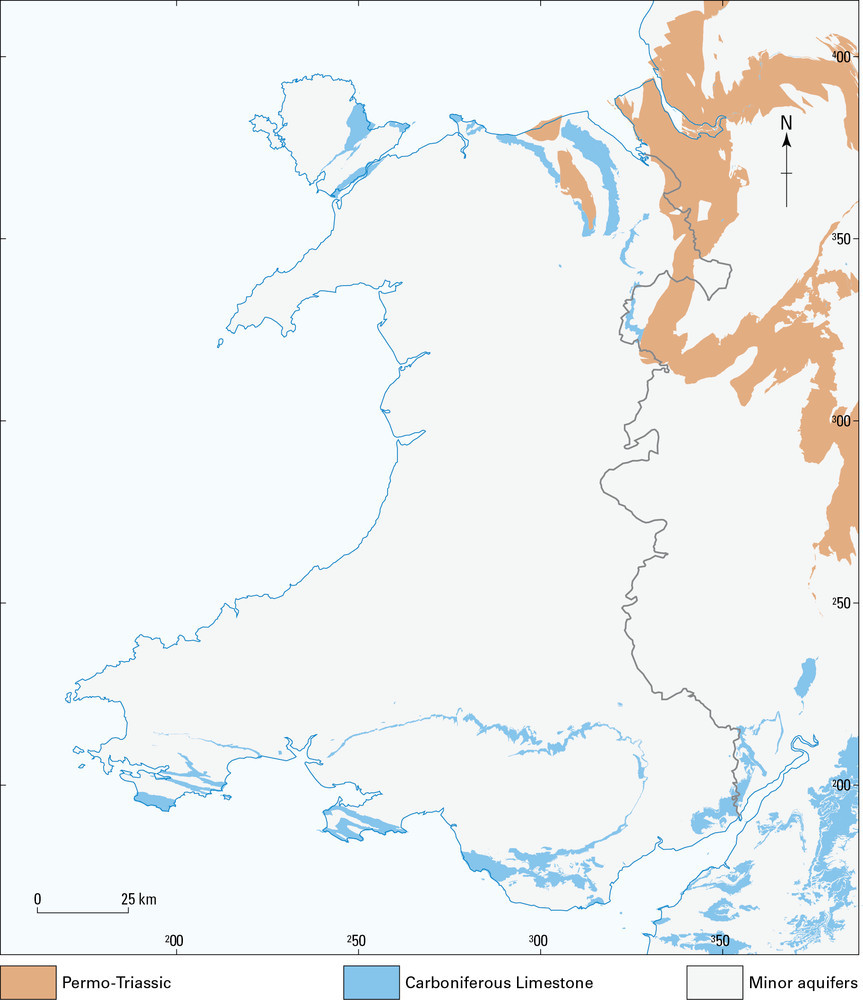
| 08:35, 20 May 2014 | P859288.jpg (file) |  |
142 KB | Dbk | Map of principal and secondary aquifers in Wales. | 1 |
| 08:46, 20 May 2014 | P802422.jpg (file) |  |
173 KB | Dbk | Abergwesyn Pass between Aberystwyth and Llanwrtyd Wells, showing typical Silurian upland scenery. P802422. | 1 |
| 16:03, 20 May 2014 | Bgskst logo.png (file) | 48 KB | Dbk | 2 | ||
| 16:48, 20 May 2014 | P589760.jpg (file) |  |
207 KB | Dbk | Northern Ireland | 1 |
| 16:49, 20 May 2014 | P717869.jpg (file) |  |
330 KB | Dbk | Bradgate Park, Leicestershire. | 1 |
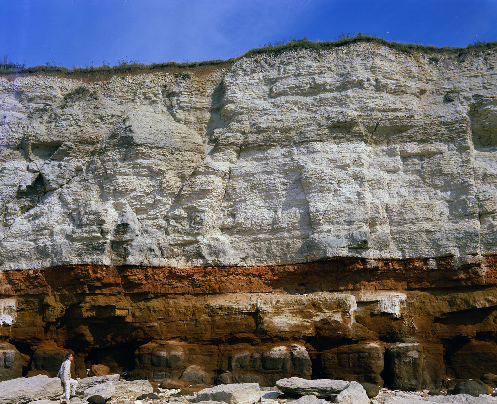
| 09:54, 22 May 2014 | P210683.jpg (file) |  |
442 KB | Dbk | Lithology of Hunstanton Cliffs, near the lighthouse. Looking SE. The Lower Chalk is divided here into two zones, the lower being that of Schloenbachia varians and the upper that of Holaster subglobosus. The junction of the zones is taken at the base of... | 2 |
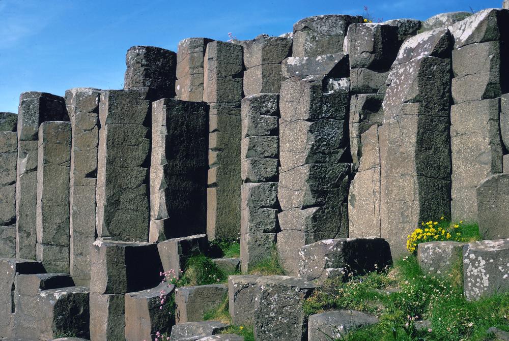
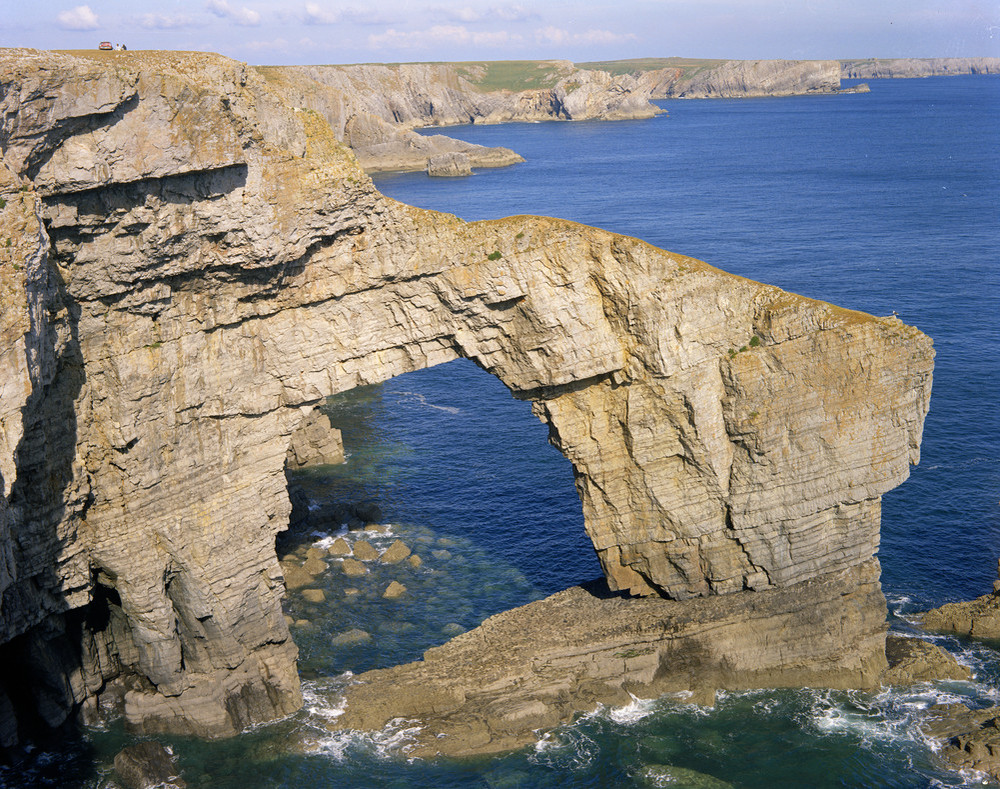
| 09:56, 22 May 2014 | P006690.jpg (file) |  |
396 KB | Dbk | The Green Bridge of Wales'. Looking E. The Green Bridge of Wales'. Natural arch. A natural arch eroded into Carboniferous Limestone. | 1 |
| 09:58, 22 May 2014 | P512666.jpg (file) |  |
150 KB | Dbk | Hydrogeology - Arran. | 1 |
| 10:48, 22 May 2014 | P786835.jpg (file) |  |
204 KB | Dbk | Summary of the geological succession in the Bath district. | 1 |
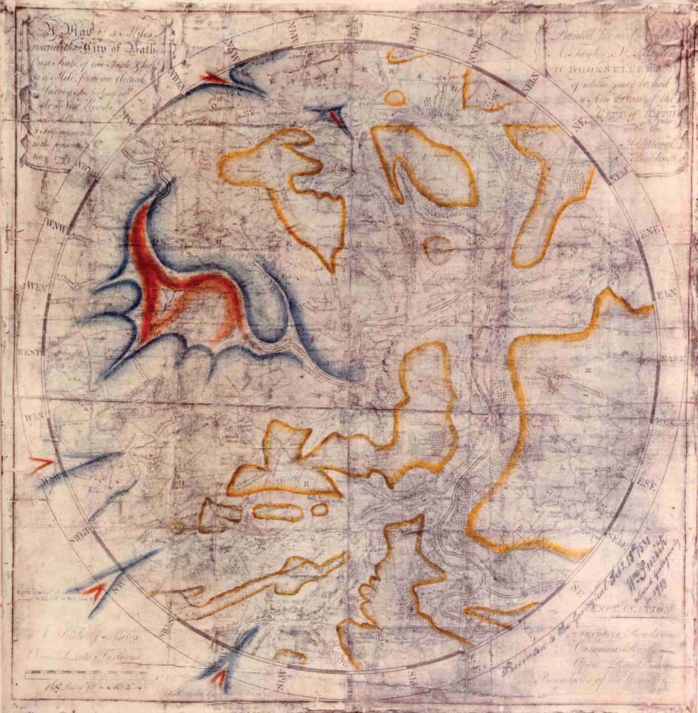
| 10:52, 22 May 2014 | P786837.jpg (file) |  |
379 KB | Dbk | Geological map of Bath drawn by William Smith in 1799. | 1 |
| 10:56, 22 May 2014 | P785914.jpg (file) |  |
169 KB | Dbk | Generalised pre-Permian subcrop map of the district. Sections 1. and 2 are lines of section shown on the published 1:50 000 geological map (Sheet 265, Bath). | 1 |
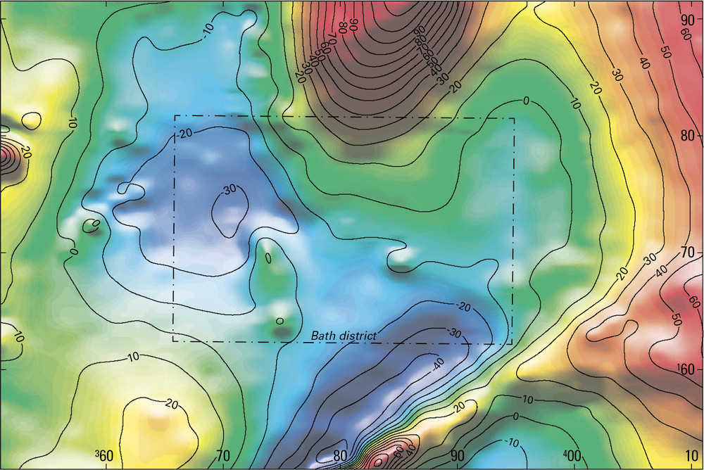
| 11:00, 22 May 2014 | P785915.jpg (file) |  |
298 KB | Dbk | Bouguer gravity anomaly map of the Bath district and adjacent areas. | 1 |
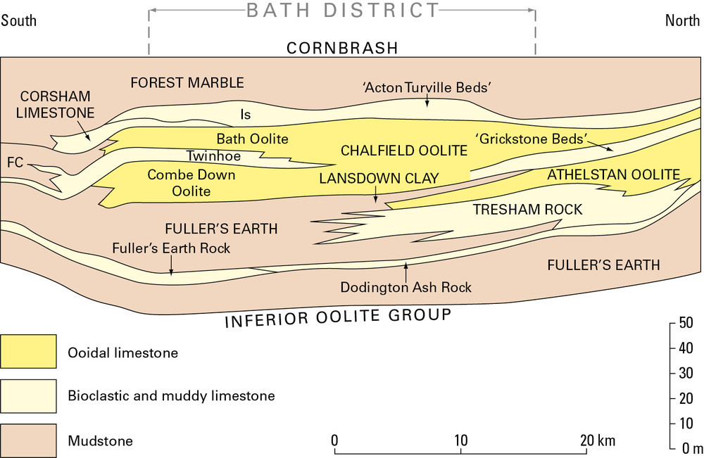
| 11:42, 22 May 2014 | P785916.jpg (file) |  |
141 KB | Dbk | Simplified cross-section showing lithostratigraphical relationships in the Bathonian strata of the south Cotswolds. Not to scale. | 1 |
| 11:45, 22 May 2014 | P731874.jpg (file) |  |
74 KB | Dbk | 1 | |
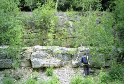
| 11:47, 22 May 2014 | P210749.jpg (file) |  |
527 KB | Dbk | N. side, Corsham railway-cutting. Looking N. Upper Rags, Great Oolite. Current bedded shell-limestones and shelly oolitic limestones resting on a patch-reef (rubbly bedding) immediately west of milepost 99. The head of the hammer rests on the top of th... | 1 |
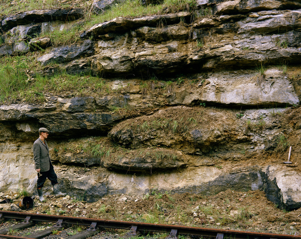
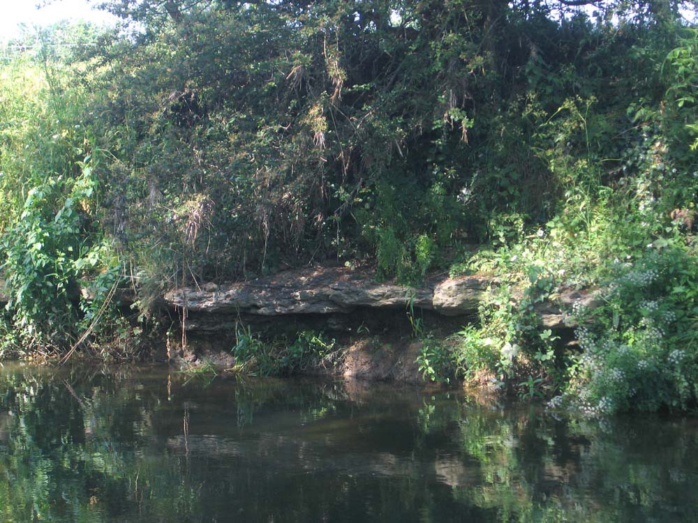
| 11:49, 22 May 2014 | P692881.jpg (file) |  |
223 KB | Dbk | The Kellaways Sand Member of the Kellaways Formation, exposed at its type section in the bank of the River Avon at Kellaways. | 1 |
| 12:10, 22 May 2014 | P785918.jpg (file) |  |
249 KB | Dbk | Aeromagnetic anomaly map of the Bath district and adjacent areas. | 1 |
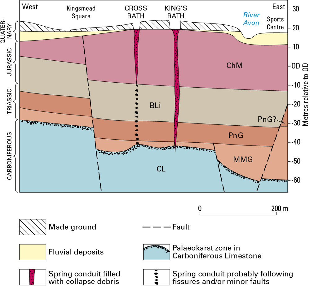
| 12:13, 22 May 2014 | P785919.jpg (file) |  |
153 KB | Dbk | Cross-section showing the geological setting of the Bath hot springs. For key to bedrock units, see Geological Description. | 1 |