Uploads by Agarcia
Jump to navigation
Jump to search
This special page shows all uploaded files.
| Date | Name | Thumbnail | Size | Description | Versions |
|---|---|---|---|---|---|
| 12:27, 20 July 2023 | Picture1 150ppi.jpg (file) |  |
99 KB | Team members setting up the [https://doi.org/10.1016/j.coastaleng.2019.103580 portable streamer trap devices] used to measure sediment transport on mixed sand and gravel beaches at Minsmere, eastern England, UK – BGS © UKRI | 1 |
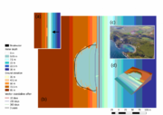
| 13:22, 20 July 2023 | Lolworthcoveweb8a07.png (file) |  |
151 KB | 1 | |
| 10:26, 25 July 2023 | Saga-logo.png (file) |  |
58 KB | SAGA is a Free Open Source Software (FOSS), which generally means that you have the freedom to run the program, for any purpose, to study how the program works and to modify it, to redistribute copies, to improve the program, and release the improvements to the public. Except for the SAGA Application Programming Interface (API) most SAGA source codes have been licenced under the GNU General Public Licence or GPL. The GPL requires derived works to be available under the same or a comparable... | 1 |
| 11:20, 25 July 2023 | ODSAS.JPG (file) |  |
61 KB | Open Digital Shoreline Analysis System: ODSAS v1.0 Source J. Mar. Sci. Eng. 2022, 10(1), 26; https://doi.org/10.3390/jmse10010026 | 1 |
| 14:41, 25 July 2023 | CliffMetrics.png (file) | 46 KB | Lower resolution image. | 2 | |
| 09:39, 12 February 2024 | P638726.jpg (file) |  |
449 KB | Seaton Cliffs at Mason's Cave in conglomerate and sandstone of the Burnside Sandstone Formation (Stratheden Group) with storm beach ridges in coarse gravel. | 1 |
| 09:44, 12 February 2024 | P025917.jpg (file) |  |
232 KB | Parkfield, about 1.25 miles south of Lowestoft. Coast erosion at Pakefield south of Lowestoft. The low cliffs along the coast here are composed of Glacial Sands and Gravels, a loosely-aggregated deposit that offers little resistance to the erosive action of the sea. An exceptionally high tide on November 30th 1936 enabled the waves to attack the cliffs on the north side of Beach Street, causing strips of cliff to fall and abandoned houses to collapse into the sea. | 1 |
| 14:56, 13 February 2024 | GBCoast Approach WPs.png (file) |  |
227 KB | Task 0 changed to WP0 | 2 |
| 11:15, 14 February 2024 | P210742.jpg (file) |  |
386 KB | Caption: Shingle storm beach and intertidal sand flat at Snettisham Scalp, Norfolk. Looking north at Snettisham Scalp at the shingle storm beach and intertidal sand flat. On this, the outer face of the storm beach, the gravel is rather coarser and contains a higher proportion of chalk than on the crest of the ridge. Successive high tide marks are indicated by the strand lines of weed. On the left of the picture Wolferton Creek separates the intertidal sand flat from a narrow belt of clay and... | 1 |