Uploads by Scotfot
Jump to navigation
Jump to search
This special page shows all uploaded files.
| Date | Name | Thumbnail | Size | Description | Versions |
|---|---|---|---|---|---|
| 17:07, 3 July 2014 | British Regional Geology areas map.jpg (file) |  |
101 KB | The map shows the boundaries of the BGS British Regional Geology areas | 1 |
| 17:28, 3 July 2014 | Arthurs Seat excursion map.jpg (file) |  |
75 KB | A map showing the numbered localities on the Arthurs Seat excursion | 1 |
| 17:38, 3 July 2014 | Salisbury Crags.jpg (file) |  |
106 KB | An image of Salisbury Crags viewed from Blackford Hill. Photograph by Bob McIntosh. | 1 |
| 15:53, 4 July 2014 | P005962.jpg (file) |  |
246 KB | Hutton's Section, Salisbury Craigs, Holyrood Park. Classic locality associated with James Hutton; shows intrusive features at base of Salisbury Craigs sill; teschenite chilled by sediment; sediments broken, twisted and baked by intrusion. | 1 |
| 16:10, 4 July 2014 | Lothian Geology cover.jpg (file) |  |
9 KB | The front cover of: Lothian Geology: An Excursion Guide by A. D. McAdam and Euan Clarkson | 1 |
| 17:07, 4 July 2014 | Pentland Hills.jpg (file) |  |
115 KB | A view of the Pentland Hills looking North from Scald Law. By Bob McIntosh. | 1 |
| 19:41, 7 February 2015 | P001324.jpg (file) |  |
253 KB | Oblique aerial view of Calton Hill and the Arthur's Seat volcano, looking from the north-west. | 1 |
| 20:24, 7 February 2015 | Water of Leith Valley.png (file) | 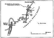 |
71 KB | Water of Leith Valley. Map from Lothian geology: an excursion guide. Edinburgh : Edinburgh Geological Society, 1986. | 1 |
| 20:40, 7 February 2015 | P002937.jpg (file) |  |
285 KB | Oblique aerial view of Edinburgh Castle from the south. A classic example of crag and tail featuring. The Castle is built on a basaltic plug of Lower Carboniferous age intruded into Cementstone Group (Dinantian) strata. The Castle Hill, together with t... | 1 |
| 19:21, 15 February 2015 | EdinburghCityCentreBuildingStonesExcursion.jpg (file) |  |
1.49 MB | Building stones of Edinburgh excursion map.From Lothian geology :an Excursion guide. | 1 |
| 19:43, 15 February 2015 | BuildingStomesOfEdinburghMap.jpg (file) |  |
289 KB | Building stones of Edinburgh excursion map | 1 |
| 21:20, 15 February 2015 | BlackfordHillExcursionMap.jpg (file) |  |
315 KB | Blackford Hill and Dreghorn excursion map. From Lothian Geology and excursion guide. Edinburgh : Edinburgh Geological Society, 1996. | 1 |
| 21:27, 15 February 2015 | GrantonAndWardieShoreExcursionMap.jpg (file) |  |
591 KB | Granton And Wardie Shore excursion map. From Lothian Geology: an excursion guide. Edinburgh : Edinburgh Geological Society, 1996. | 1 |
| 21:35, 15 February 2015 | KilspindieShoreExcursionMap.jpg (file) |  |
327 KB | Kilspindie shore - an excursion From Lothian Geology: an excursion guide. Edinburgh : Edinburgh Geological Society, 1996. Map 8. | 1 |
| 21:42, 15 February 2015 | NorthBerwickCantyBayExcursionMap.jpg (file) |  |
435 KB | North Berwick to Canty Bay excursion map. From Lothian Geology: an excursion guide. Edinburgh : Edinburgh Geological Society, 1996. Map 9. | 1 |
| 18:26, 16 February 2015 | NorthBerwickYellowCraigToCheeseBayExcursionMap.jpg (file) |  |
342 KB | Yellow Craig to Cheese Bay excursion map. | 1 |
| 19:01, 16 February 2015 | GarletonHillsVolcanicRocksExcursionMap.jpg (file) |  |
741 KB | Garleton Hills, excursion map | 1 |
| 19:13, 16 February 2015 | P000690.jpg (file) |  |
114 KB | Traprain Law, a phonolite laccolith intruded into Lower Carboniferous sediments and volcanic rocks which form the drift-covered foreground. Taken from Balfour Monument at Blaikie Heugh, 3 km. south-west of East Linton. | 1 |
| 21:40, 16 February 2015 | P001296.jpg (file) |  |
218 KB | Oblique aerial view of Dunbar, looking from the west-north-west. East Lothian. West Bay on the right front is a large vent agglomerate crossed by dykes/joints with bedded red sandstones above; Dunbar Castle and harbour entrance is situated on vent aggl... | 1 |
| 21:50, 16 February 2015 | P001088.jpg (file) |  |
139 KB | The Harbour, Dunbar, East Lothian. Cliffs cut into volcanic vent agglomerate of Calciferous Sandstone Measures age. Ruins of Dunbar Castle, on a raised beach platform. North Berwick Law phonolitic trachyte plug in distance. The vent, one of several in ... | 1 |
| 22:09, 20 February 2015 | DunbarBelhavenAndTheParadeExcursionMap.jpg (file) |  |
470 KB | Dunbar, Belhaven and the Parade - excursion map | 1 |
| 22:33, 20 February 2015 | DunbarExcursionMap.jpg (file) |  |
439 KB | Dunbar - excursion map | 1 |
| 17:04, 21 February 2015 | CatcraigExcursionMap.jpg (file) |  |
400 KB | Catcraig - excursion map. | 1 |
| 17:33, 21 February 2015 | P001526.jpg (file) |  |
157 KB | Catcraig Limekiln, Dunbar, East Lothian. The kiln is used for the production of lime by mixing limestone and coal, firing it, and drawing of the lime at the base. It was used for centuries by medieval builders for binding masonry and lightening interio... | 1 |
| 18:53, 21 February 2015 | SiccarPointExcursionMap.jpg (file) |  |
439 KB | Siccar Point excursion map. | 1 |
| 21:14, 21 February 2015 | LammermuirDeansExcursionMap.jpg (file) |  |
221 KB | Lammermuir Deans excursion map | 1 |
| 21:22, 21 February 2015 | P005865.jpg (file) |  |
218 KB | Fairy Castle; junction of Bladdering Cleugh and Back Burn, 3.6 km. upstream of Oldhamstocks. Dyke in Lower Old Red Sandstone conglomerate (Great Conglomerate). Conglomerate adjacent to dyke baked and very resistant, dyke generally rotten, note sharply ... | 1 |
| 21:30, 21 February 2015 | RiverNorthEskExcursionMap.jpg (file) |  |
380 KB | River North Esk excursion map. | 1 |
| 14:44, 22 February 2015 | PentlandHillsBavelawToLoganleeExcursionMap.jpg (file) |  |
998 KB | Pentland Hills Bavelaw To Loganlee Reservoir excursion map. | 1 |
| 14:56, 22 February 2015 | PentlandHillsTorphinToBonalyTowerExcursionMap.jpg (file) |  |
732 KB | Pentland Hills - Torphin to Bonaly Tower - excursion map. | 1 |
| 15:02, 22 February 2015 | NorthEskInlierExcursionMap.jpg (file) |  |
574 KB | North Esk Inlier excursion map | 1 |
| 16:46, 23 February 2015 | P000199.jpg (file) |  |
148 KB | Westwood Bing 'The Five Sisters', West Calder viewed from the south-west. West Lothian. Five conical spoil heaps of spent oil-shale known as an oil-shale bing. The freshly mined raw oil-shales were heated in retorts to produce shale-oil for distillatio... | 1 |
| 17:04, 23 February 2015 | SouthQueensferryShoreExcursionMap.jpg (file) |  |
369 KB | South Queensferry shore - excursion map | 1 |
| 18:15, 23 February 2015 | CramondShoreExcursionMap.jpg (file) |  |
448 KB | Cramond shore excursion map | 1 |
| 18:54, 23 February 2015 | RiverAvonExcursionMap.jpg (file) |  |
388 KB | River Avon - excursion map | 1 |
| 18:59, 23 February 2015 | RiverAvonAnExcursionSectionInPassageGroup.jpg (file) |  |
268 KB | Section in Passage Group | 1 |
| 19:38, 23 February 2015 | BathgateHillsExcursionMap.jpg (file) |  |
563 KB | Bathgate Hills excursion map | 1 |
| 18:50, 7 March 2015 | FastCastleExcursionMap.png (file) | 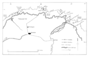 |
338 KB | Fast Castle - an excursion map. | 1 |
| 18:59, 7 March 2015 | P002932.jpg (file) |  |
281 KB | Oblique aerial view of the Berwickshire coast at Brander, 1.3 km. east of Fast Castle, Berwickshire. Anticline in Silurian rocks. View from the north-east of a spectacular anticline in Silurian (Llandovery) rocks at Brander, about 1.3 km. east of Fast... | 1 |
| 19:35, 7 March 2015 | StAbbsHeadExcursionMap.jpg (file) |  |
566 KB | St. Abb's Head Excursion map. | 1 |
| 19:41, 7 March 2015 | P005893.jpg (file) |  |
182 KB | St. Abb's Head, Horsecastle Bay. View N. Grits and lava. Bedded tuffaceous grits overlie massive lava in the foreground, and are overlain on the headland by a later flow with a clearly irregular base. Such interrelations of bedded grits are not uncommo... | 1 |
| 20:12, 7 March 2015 | ColdinghamExcursionMap.jpg (file) |  |
329 KB | Coldingham - an excursion map. | 1 |
| 20:18, 7 March 2015 | P005896.jpg (file) |  |
144 KB | Linkim Kip. Sea stack. Stack in greywackes of Linkim Beds (Silurian). The beds have a low inverted dip to north-north-west and are traversed by a drag-fold whose axial planes dip at about 50 degrees to north-north-east. This fold possibly induced by a... | 1 |
| 21:43, 7 March 2015 | EyemouthExcursionMap.jpg (file) |  |
429 KB | Eyemouth - Excursion Map | 1 |
| 21:48, 7 March 2015 | P005900.jpg (file) |  |
218 KB | Eyemouth Fort. SW view. Glacial deposits. Boulder clay rests on bedded gravel with thick band of bedded sand. On left the lower beds abut against pale purple lavas of Lower Old Red Sandstone age, marking the south-east limit of a channel. The drift dep... | 1 |
| 08:32, 8 March 2015 | Burnmouth.jpg (file) |  |
486 KB | Burnmouth - excursion map. | 1 |
| 08:33, 8 March 2015 | LambertonExcursionMap.jpg (file) |  |
593 KB | Lamberton excursion map | 1 |
| 09:00, 8 March 2015 | BurnmouthCarboniferousFossils.jpg (file) |  |
541 KB | Carboniferous fossis from the Burnmouth area. Schizodus axiformis (Phillips) x0.7 Visean Canobius ramsayi Traquair [after Traquair] x1; Visean | 1 |
| 15:40, 8 March 2015 | BerwickSpittalNorthExcursionMap.jpg (file) |  |
365 KB | Spittal North - excursion map | 1 |
| 15:41, 8 March 2015 | BerwickSpittalCentralExcursionMap.jpg (file) |  |
386 KB | Spittal central - excursion map. | 1 |