File list
Jump to navigation
Jump to search
This special page shows all uploaded files.
| Date | Name | Thumbnail | Size | User | Description | Versions |
|---|---|---|---|---|---|---|
| 07:17, 20 May 2014 | P859285.jpg (file) |  |
65 KB | Dbk | Schematic cross section of the central foreshore at Whiteford Sands showing the steepening of the hydraulic gradient away from the dune front following storm damage in 1966. | 1 |
| 07:16, 20 May 2014 | P802434.jpg (file) |  |
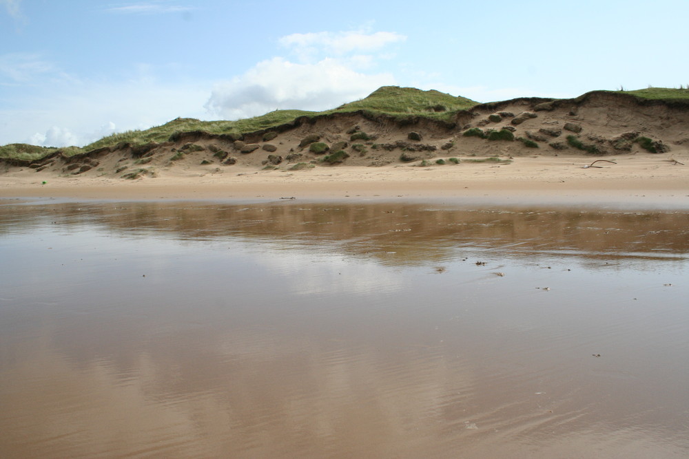
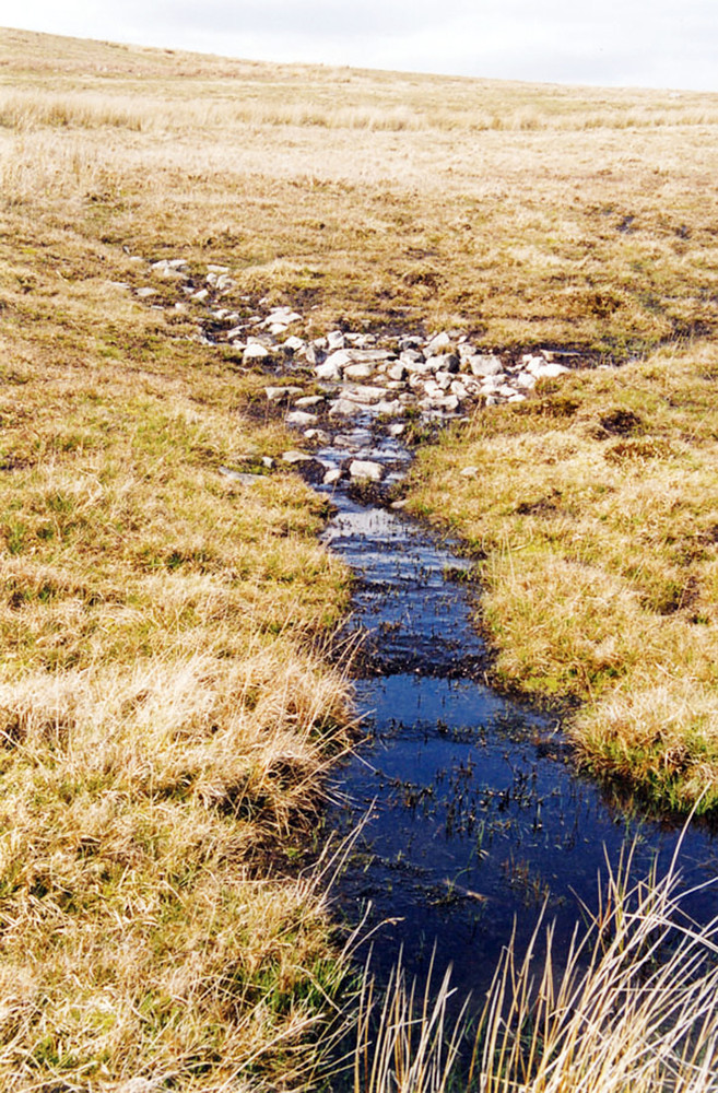
109 KB | Dbk | Groundwater discharge along the foreshore beneath Whiteford Burrows on the Gower Peninsula. | 1 |
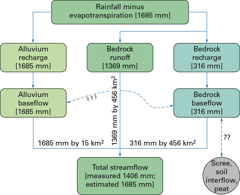
| 07:12, 20 May 2014 | P859284.jpg (file) |  |
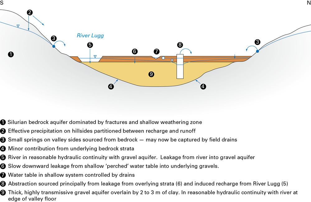
120 KB | Dbk | Schematic conceptual model of the hydrogeology of the Upper Lugg catchment (after ESI, 2006). | 1 |
| 07:11, 20 May 2014 | P859283.jpg (file) |  |
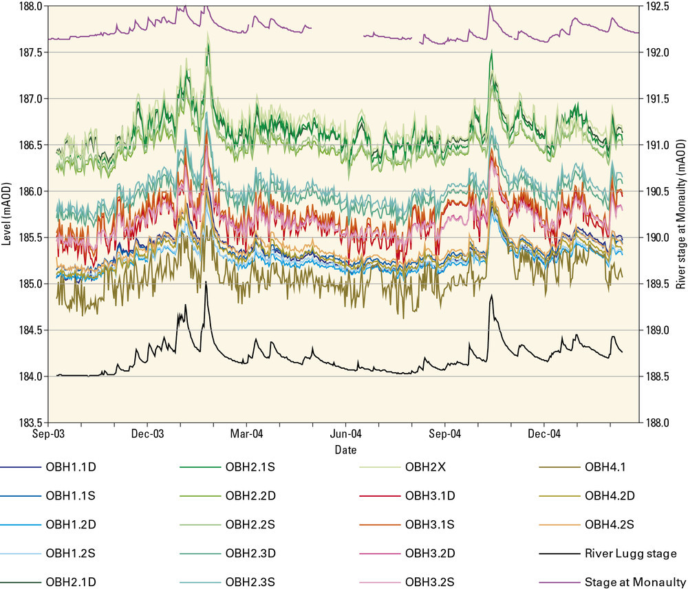
82 KB | Dbk | Groundwater levels in Environment Agency observation boreholes in the Upper Lugg catchment (after ESI, 2006). | 1 |
| 07:09, 20 May 2014 | P859282.jpg (file) |  |
252 KB | Dbk | Groundwater levels monitored by Dŵr Cymru in the gravel aquifer near Pilleth (after ESI, 2006). | 1 |
| 07:06, 20 May 2014 | P859281.jpg (file) |  |
99 KB | Dbk | Schematic section of the central part of the Lower Afon Teifi showing the main flow components (after Robins et al., 2000). | 1 |
| 07:05, 20 May 2014 | P859280.jpg (file) |  |
157 KB | Dbk | Distribution of superficial deposits in Afon Teifi showing borehole well and spring locations (after Robins et al., 2000). | 1 |
| 07:03, 20 May 2014 | P802432.jpg (file) |  |
232 KB | Dbk | 1 | |
| 07:01, 20 May 2014 | P802431.jpg (file) |  |
361 KB | Dbk | Triassic Blue Anchor Formation exposed in cliffs at St Mary's Well Bay, south of Penarth. | 1 |
| 06:59, 20 May 2014 | P859279.jpg (file) |  |
78 KB | Dbk | Range of major ion concentrations in Permo-Triassic groundwaters in West Cheshire and Dee catchment (after Griffiths et al., 2002). | 1 |
| 06:57, 20 May 2014 | P859278.jpg (file) |  |
139 KB | Dbk | The Vale of Clwyd Triassic aquifer (after ESI, 2003). | 1 |
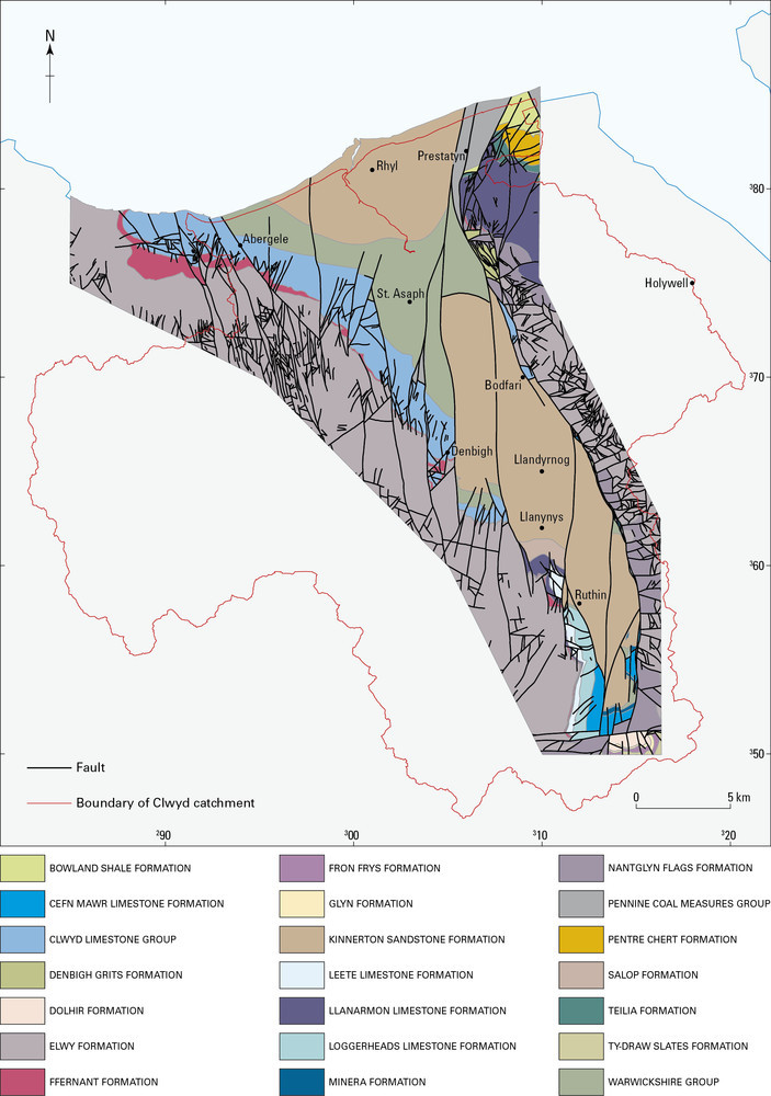
| 06:55, 20 May 2014 | P859277.jpg (file) |  |
160 KB | Dbk | Vale of Clwyd—geological setting. | 1 |
| 06:52, 20 May 2014 | P802430.jpg (file) |  |
252 KB | Dbk | Jurassic Lias limestone cliffs at Nash Point, South Glamorgan. | 1 |
| 15:14, 19 May 2014 | P859276.jpg (file) |  |
73 KB | Dbk | Piper diagram showing the distribution of the four main groundwater types in the South Wales Coal Measures Group (after Ineson, 1967). | 1 |
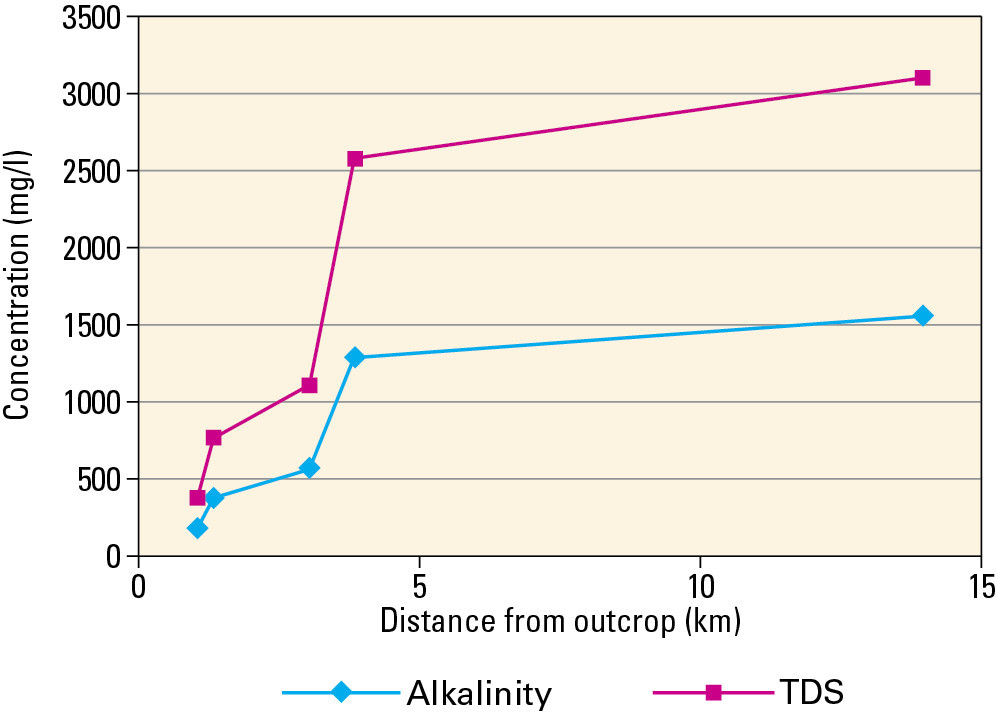
| 15:13, 19 May 2014 | P859275.jpg (file) |  |
75 KB | Dbk | Alkalinity and total dissolved solids evolution down dip in the Old Coal Horizon (after Ineson, 1967). | 1 |
| 15:11, 19 May 2014 | P802425.jpg (file) |  |
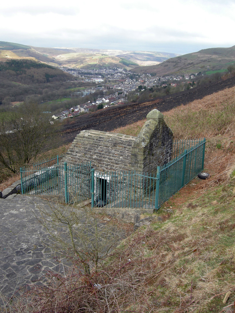
336 KB | Dbk | St Mary's Well at Penrhys – a spring issuing from Pennant Sandstone on the side of the Rhondda Fach above Fernadale. | 1 |
| 15:10, 19 May 2014 | P802424.jpg (file) |  |
169 KB | Dbk | The main shaft and buildings at Tower Colliery prior to closure in 2008. The dark green area is reclaimed opencast land and contrasts with the yellow-green natural vegetation in the foreground. | 1 |
| 15:07, 19 May 2014 | P802426.jpg (file) |  |
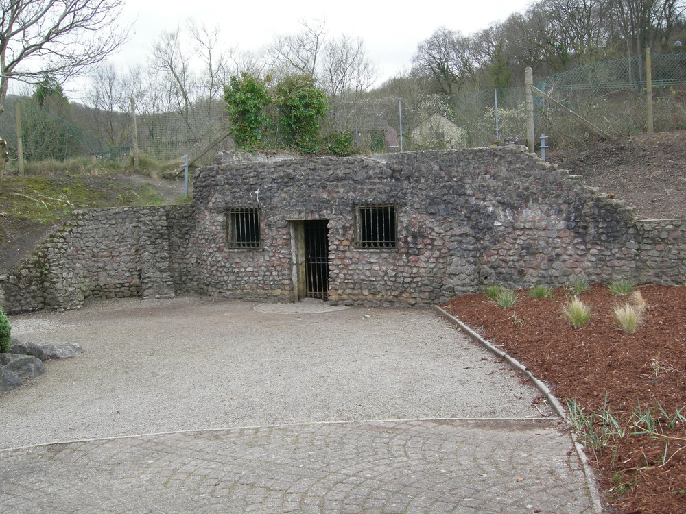
314 KB | Dbk | Taff's Well - a warm spring rising from faulted Avon Group strata on the bank of the Taff, now housed in an enclosed bath. | 1 |
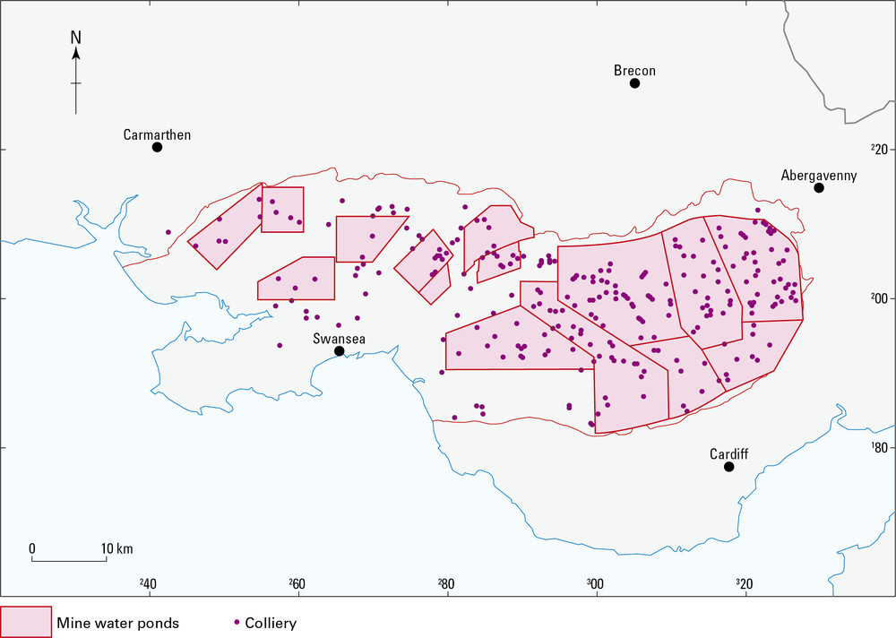
| 15:06, 19 May 2014 | P859274.jpg (file) |  |
120 KB | Dbk | The discrete drainage ponds within the former operational South Wales Coalfield (after Lewis et al., 2000). | 1 |
| 15:04, 19 May 2014 | P859292.jpg (file) |  |
174 KB | Dbk | Screen shot showing the structure on the base of the South Wales Lower Coal Measures Formation with contours at 200 m intervals: dark purple -2500 m OD; green -1000 m OD; orange 0m OD. | 1 |
| 15:03, 19 May 2014 | P859291.jpg (file) |  |
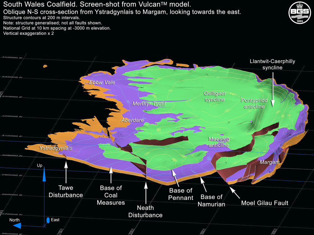
214 KB | Dbk | Screen shot showing an oblique north-south section through Margam looking west and illustrating the low angle Moel Gilau fault. | 1 |
| 15:01, 19 May 2014 | P859290.jpg (file) |  |
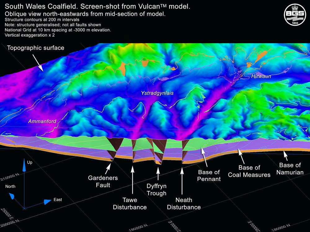
252 KB | Dbk | Oblique west–east screen shot from VULCAN model along national grid northing 200000 looking towards the north-west. | 1 |
| 14:57, 19 May 2014 | P859273.jpg (file) |  |
93 KB | Dbk | Sketch map of the Pembroke Limestone group outcrop along the North Crop (after Gasgoine, 1989). | 1 |
| 14:57, 19 May 2014 | P802428.jpg (file) |  |
363 KB | Dbk | One of many springs flowing from boggy ground at the junction of the basal Namurian grit and the underlying Avon Group near Trefil, north of Tredegar . | 1 |
| 14:56, 19 May 2014 | P859272.jpg (file) |  |
111 KB | Dbk | The distribution of Carboniferous strata in North Wales. | 1 |
| 14:52, 19 May 2014 | P802429.jpg (file) |  |
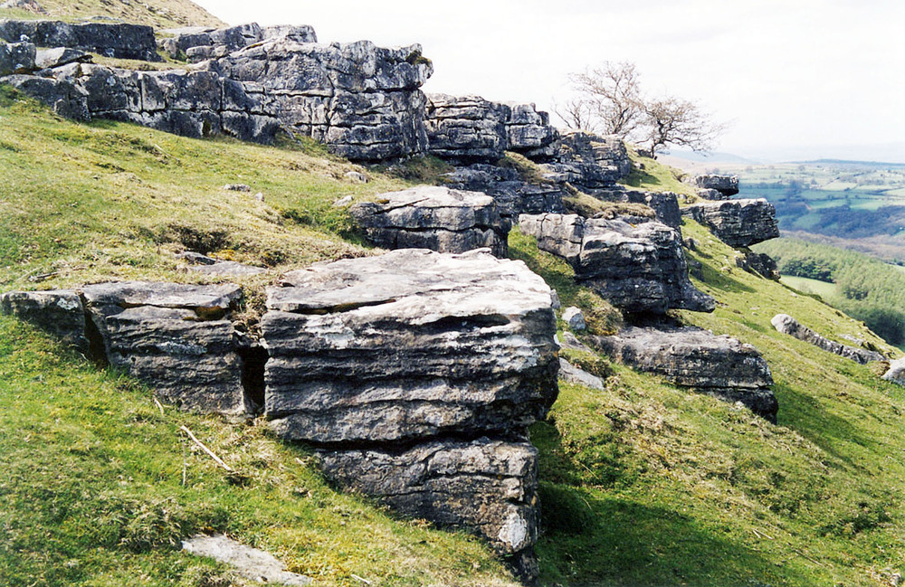
361 KB | Dbk | Karstic Avon Group strata at Mynydd Llangattog. | 1 |
| 14:50, 19 May 2014 | P802427.jpg (file) |  |
350 KB | Dbk | Waterfall on shales in the Afon Mellte Gorge north of Glyn Neath. | 1 |
| 14:43, 19 May 2014 | P859271.jpg (file) |  |
77 KB | Dbk | Range of major ion concentrations in the Devonian sandstone in south west wales and parts of Herefordshire (after Moreau et al., 2004). | 1 |
| 14:41, 19 May 2014 | P802423.jpg (file) |  |
277 KB | Dbk | Holy Spring at Maen-Du, north of Brecon Cathedral. | 1 |
| 14:40, 19 May 2014 | P542858.jpg (file) |  |
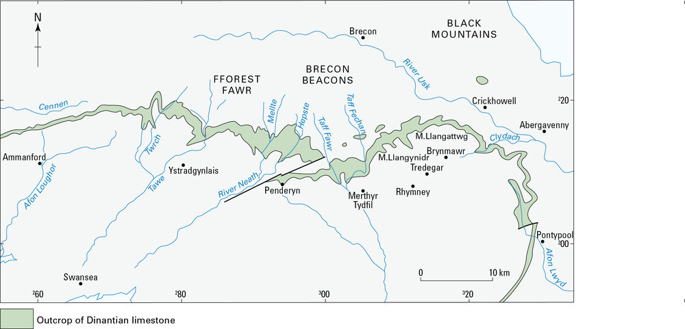
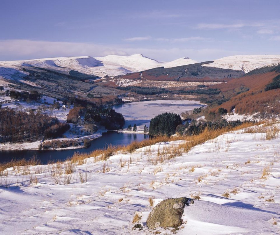
201 KB | Dbk | View of the Brecon Beacons capped by Old Red Sandstone Plateau Beds with the Neuadd and Pontsticill Reservoir in the Taff Fechan valley from the Twynau Gwynian north of Merthyr Tydfil. | 1 |
| 14:38, 19 May 2014 | P859270.jpg (file) |  |
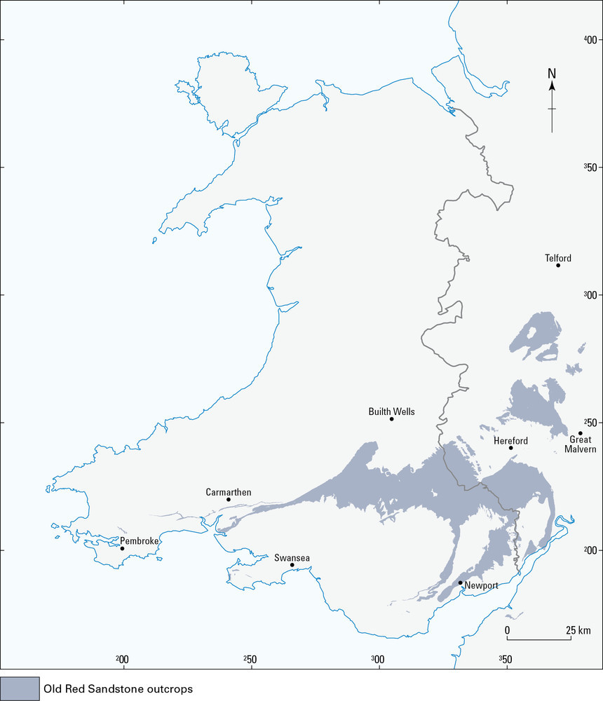
111 KB | Dbk | Outline distribution of the old Red Sandstone outcrops. | 1 |
| 14:35, 19 May 2014 | P859269.jpg (file) |  |
78 KB | Dbk | Schematic cross-section of the Builth Inlier illustrating probable evolution of the Llandrindod wells spa waters (after Edmunds et al., 1998). | 1 |
| 14:34, 19 May 2014 | P802421.jpg (file) |  |
307 KB | Dbk | The Chalybeate Spring of Llandrindod Wells. | 1 |
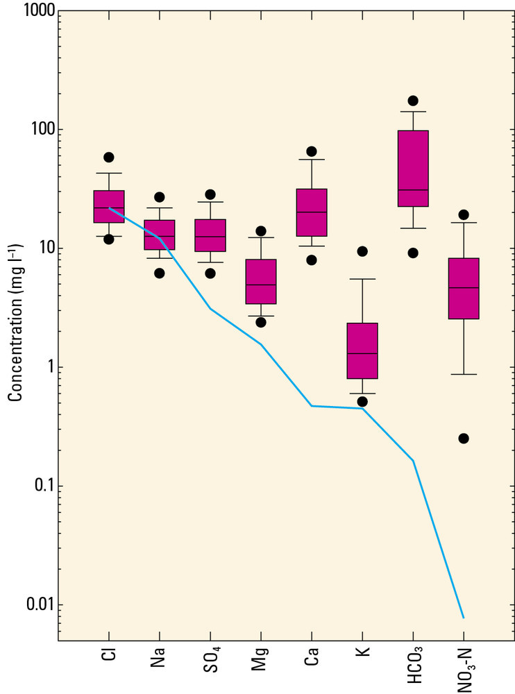
| 14:33, 19 May 2014 | P859268.jpg (file) |  |
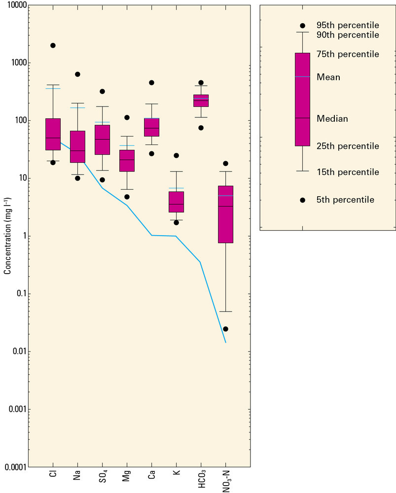
65 KB | Dbk | Box and whisker plot of major ion concentrations and the normalised sea water line. The mean 25th and 75th percentile are bars and the 5 and 95th percentile are dots (after Robins et al., 2000. | 1 |
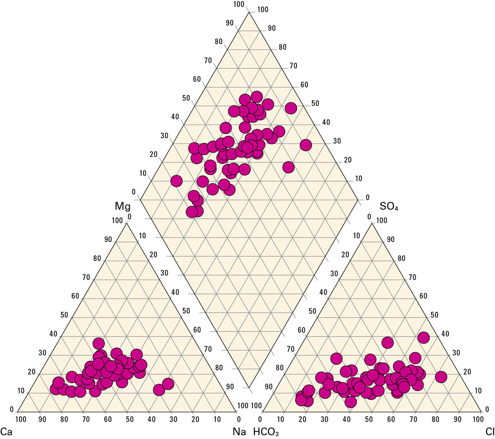
| 14:32, 19 May 2014 | P859267.jpg (file) |  |
206 KB | Dbk | Piper diagram showing major ion distribution in groundwaters in Afon Teifi (after Robins et al., 2000). | 1 |
| 14:27, 19 May 2014 | P859266.jpg (file) |  |
137 KB | Dbk | Schematic section of the central area of the lower Afon Teifi catchment showing the main flow components (after Robins et al., 2000). | 1 |
| 14:19, 19 May 2014 | P802420.jpg (file) |  |
243 KB | Dbk | The Afon Teifi at Cenarth flowing over on of several rock ledges that constrict the valley. | 1 |
| 14:17, 19 May 2014 | P859265.jpg (file) |  |
126 KB | Dbk | Analysis of throughflow volumes in the Afon Dulas catchment (after Glendining, 1981). | 1 |
| 14:15, 19 May 2014 | P859264.jpg (file) | 61 KB | Dbk | Schematic flow system for the Afon Dulas catchment controlled by topography, fracture orientation and fracture permeability (after Glendining, 1981. | 1 | |
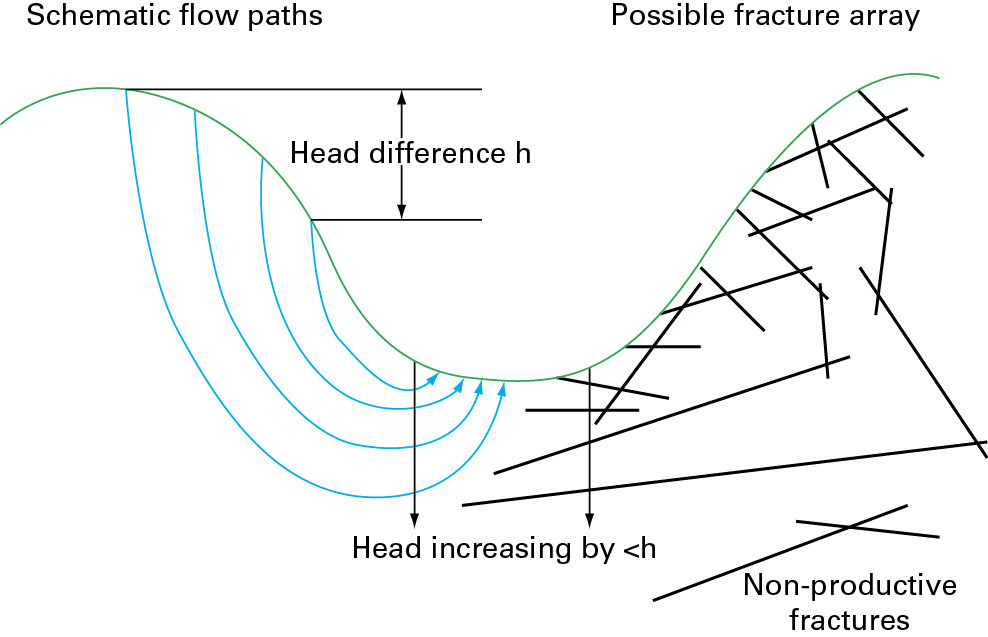
| 14:11, 19 May 2014 | P859263.jpg (file) |  |
86 KB | Dbk | Schematic cross section of a hard fractured rock upland valley such as Dinorwic, showing increasing head with depth in active fractures beneath valley bottoms. | 1 |
| 14:08, 19 May 2014 | P859262.jpg (file) |  |
86 KB | Dbk | Heat-pulse flowmeter logs for exploratory boreholes in Llanberis Slate Formation at Dinorwic (after Robertson, 1974). | 1 |
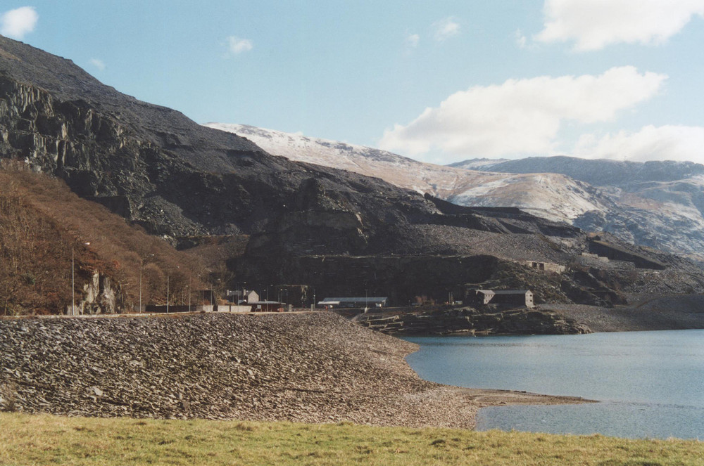
| 14:05, 19 May 2014 | P802416.jpg (file) |  |
216 KB | Dbk | Llanberis slate quarry. | 1 |
| 13:59, 19 May 2014 | P859261.jpg (file) |  |
79 KB | Dbk | Bardsey Island: Specific Electrical Conductance (SEC)/Cl to elevation relationship in groundwater (See Webb, 2000). | 1 |
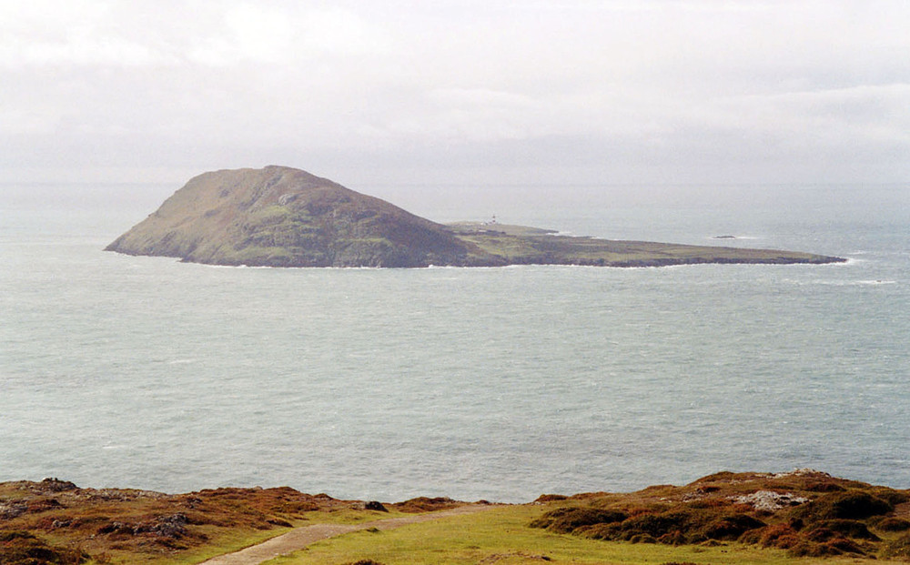
| 13:57, 19 May 2014 | P802418.jpg (file) |  |
157 KB | Dbk | Bardsey Island. | 1 |
| 13:55, 19 May 2014 | P859260.jpg (file) |  |
356 KB | Dbk | Location of springs and wells in north-western Anglesey (after Robins and MeKenzie, 2005). | 1 |
| 13:54, 19 May 2014 | P802417.jpg (file) |  |
288 KB | Dbk | Typical Cambrian coastal exposure looking towards South Stack, Holyhead Island. | 1 |
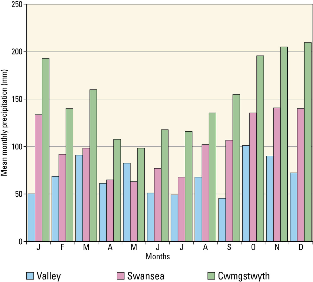
| 10:10, 19 May 2014 | P859259.jpg (file) |  |
109 KB | Dbk | Mean monthly rainfall (mm) at Valley on Anglesey, Swansea and Cwmgstwyth in Ceredigion (after http://www.metoffice.gov.uk/wl/print.html). | 1 |
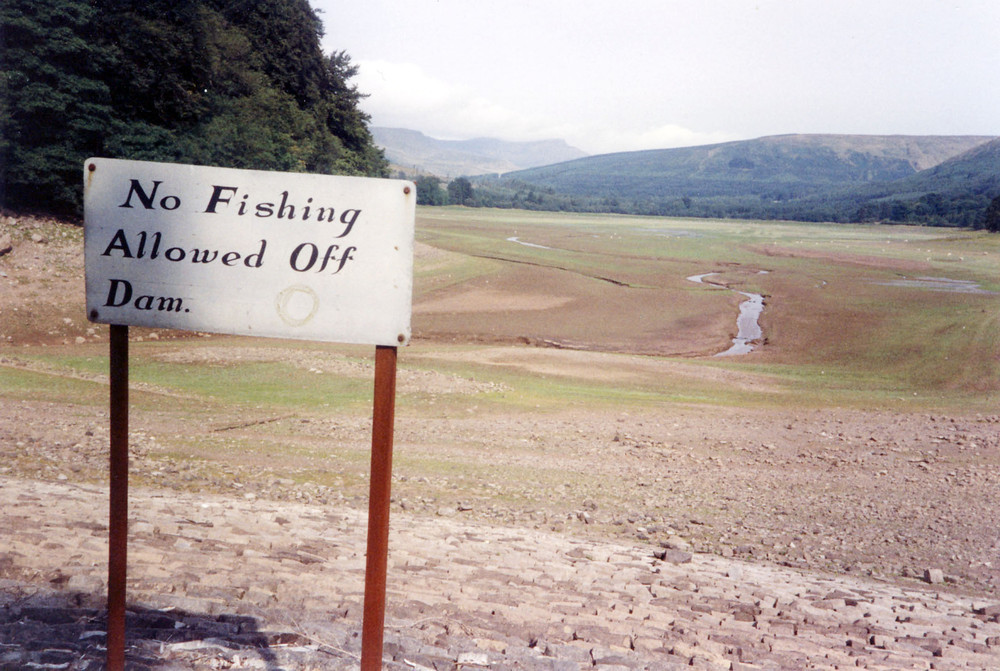
| 10:02, 19 May 2014 | P802060.jpg (file) |  |
227 KB | Dbk | ... and in drought, Pen-y-Fan, in the Brecon Beacons from wall of the Neuadd Reservoir north of Merthyr Tydfil during 1976. | 1 |
| 10:01, 19 May 2014 | P802061.jpg (file) |  |
213 KB | Dbk | Elan Valley, Caben Cock dam in spate. | 1 |
| 10:00, 19 May 2014 | P802042.jpg (file) |  |
109 KB | Dbk | View from Aberaeron of the coast of Cardigan Bay extending north towards Aberystwyth. | 1 |