File list
Jump to navigation
Jump to search
This special page shows all uploaded files.
| Date | Name | Thumbnail | Size | User | Description | Versions |
|---|---|---|---|---|---|---|
| 20:21, 1 November 2015 | EGS Ballachulish Fig 05.jpg (file) |  |
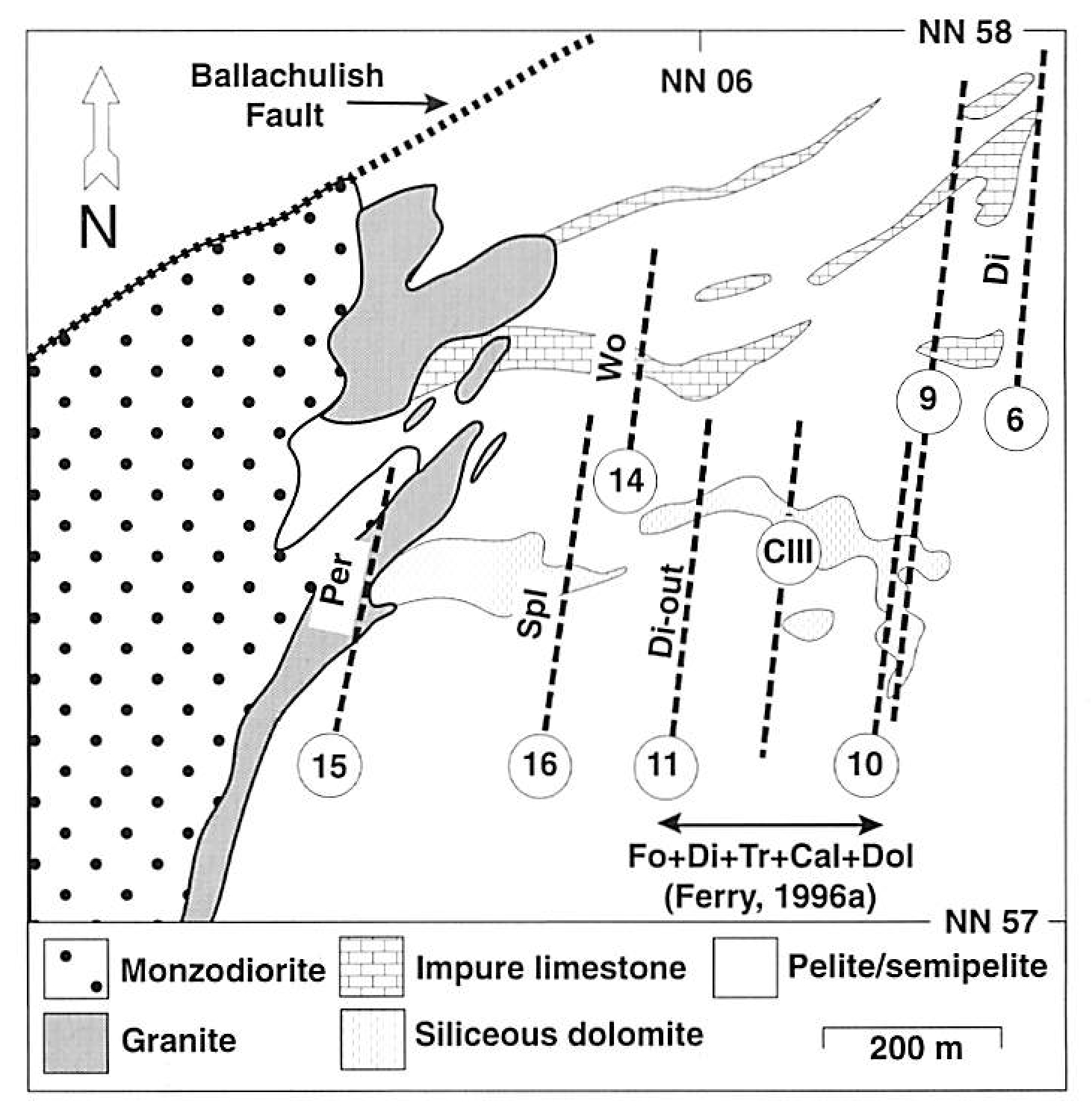
609 KB | Scotfot | Isograds in carbonate rocks from the Coire Giubhsachain syncline, northeast flank of igneous complex (Paulson & 1997; modified from Masch and Heuss-Aßbichler 1991 and Ferry, 1996a). Numbering of isograds is the same as in the text (with 'C' prefix omi... | 1 |
| 20:15, 1 November 2015 | EGS Ballachulish Fig 04.jpg (file) |  |
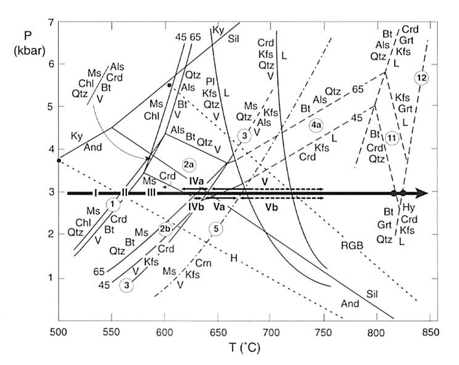
501 KB | Scotfot | Figure 4. Pressure-temperature grid of reactions in the chemical system K2O-FeO-MgO-Al2O3-SiO2-H2O for typical mineral compositions in quartz-bearing pelitic rocks from Ballachulish (Pattison Harte, 1997). Dehydration reactions below the initial meltin... | 1 |
| 20:11, 1 November 2015 | EGS Ballachulish Fig 03.jpg (file) |  |
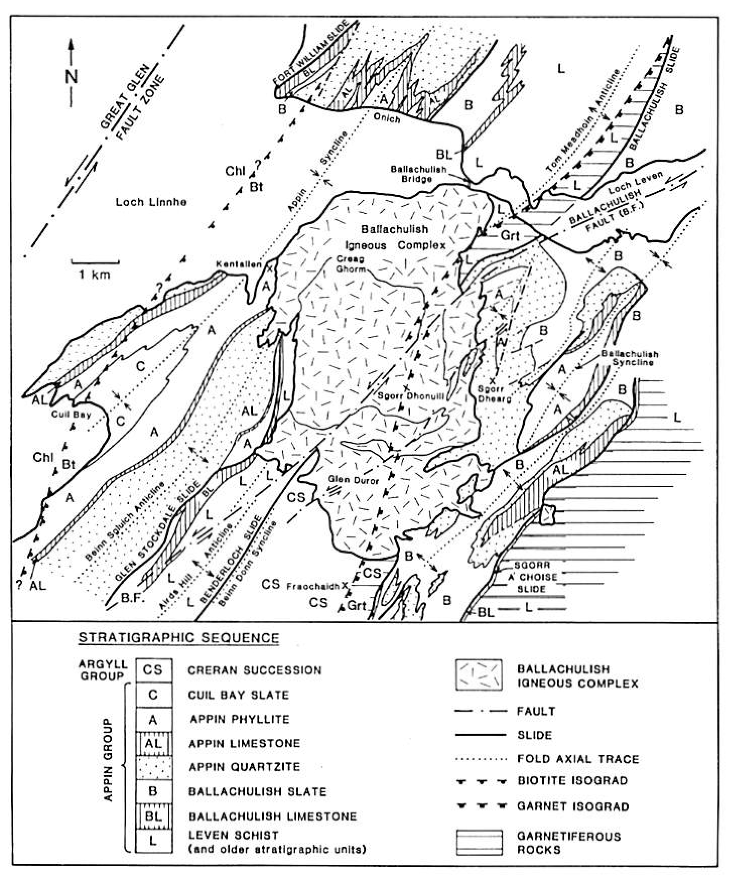
429 KB | Scotfot | Geological cross-sections through the igneous complex (see section lines on Coloured Map and Fig. 7), from Weiss (1986) and Troll and Weiss (1991). l - metasediments. Lined patient indicates pelites and semipelites; lined pattern with dots represents q... | 1 |
| 20:09, 1 November 2015 | EGS Ballachulish Fig 02.jpg (file) |  |
1.04 MB | Scotfot | Outline of lithostratigraphic units and major regional structures around the Ballachulish Igneous Complex. The position of the garnet isograd of regional metamorphism. Which formed prior to intrusion of the complex, is extrapolated across the area of t... | 1 |
| 20:07, 1 November 2015 | EGS Ballachulish Fig 01.jpg (file) |  |
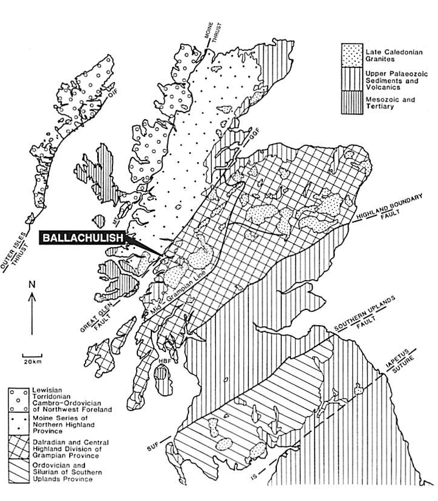
1.06 MB | Scotfot | Outline map of major geological provinces in Scotland, and the distribution of Caledonian igneous complexes ('granites'); with location of the Ballachulish area. Figure 1. From: Pattison, D.R.M. and Harte, B. The Ballachulish Igneous Complex and aure... | 1 |
| 15:22, 30 October 2015 | EGS ScottishBordersCover.jpg (file) |  |
312 KB | Scotfot | SCottish Borders Geology: An excursion guide. Front cover | 1 |
| 15:14, 30 October 2015 | EGS SJG Cover.jpg (file) |  |
269 KB | Scotfot | SCottish Journal of Geology 13(2) 1977 Cover. The Dalradian rocks of the South-West Highlands (field guide) | 1 |
| 14:55, 30 October 2015 | EGS BallachulishCover.jpg (file) |  |
493 KB | Scotfot | The Ballachulish igneous complex and aureole. Front cover. | 1 |
| 16:15, 27 October 2015 | P906517.jpg (file) |  |
136 KB | JenniferFindlay1 | Cementstone Group. Hutton Castle Barns BH [NT85SE/1], 248 yards south 16 degrees east of Hutton Castle Barns and 20 yards north of bank of Cabby Burn; depth 70 - 75 fm. P906517 | 1 |
| 16:04, 27 October 2015 | P218956.jpg (file) |  |
175 KB | JenniferFindlay1 | Chirnside, East Blanerne. Looking SE. Mudstones and cementstones of Lower Carboniferous dipping to south at 12 degrees. South-east view. P218956 | 1 |
| 15:55, 27 October 2015 | P220053.jpg (file) |  |
378 KB | JenniferFindlay1 | Hawick road section, 2 km. SE of Tushielaw, Ettrick. Looking E. Folded greywackes. Southern half of Hawick road section showing folds 3 (anticline), 4 (syncline) and 5 (imbricated) in greywacke sandstones of the Gala Group. P220053 | 1 |
| 15:06, 27 October 2015 | P005892.jpg (file) |  |
215 KB | JenniferFindlay1 | St. Abb's Head, Cauldron Cove. View SW. Grits and lava. Bedded tuffaceous grit (c. 27 m. thick) dips to left and overlies massive lava (lower left). The lava appears to be thrust over bedded grits in right foreground. Lower Old Red Sandstone. P005892 | 1 |
| 14:52, 27 October 2015 | P000813.jpg (file) |  |
172 KB | JenniferFindlay1 | Oblique aerial view of St. Abb's from the east. Berwickshire. The rocks in the foreground are intrusive porphyrites and agglomerates. The rocks on the shore are intrusive porphyrites and unbedded agglomerates, probably within a volcanic vent, of Lower... | 1 |
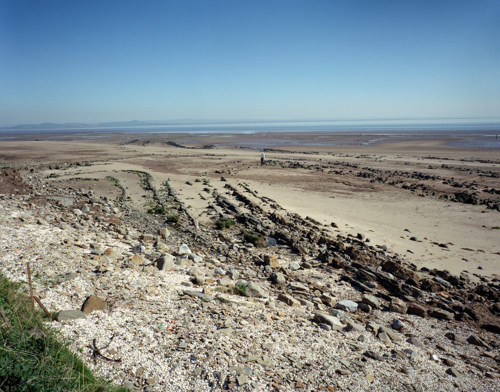
| 14:19, 27 October 2015 | P220465.jpg (file) |  |
373 KB | JenniferFindlay1 | Taken from 300 m. S. of Hogus Point, Carsethorne. Looking NNE, across the estuary of the River Nith. Arbigland Limestone Formation. Plunging anticlinal-synclinal pair in thin-bedded limestones and sandstones. P220465 | 1 |
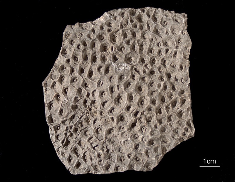
| 14:13, 27 October 2015 | P511132.jpg (file) |  |
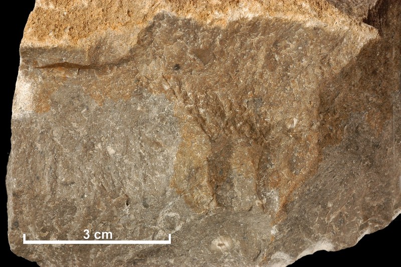
128 KB | JenniferFindlay1 | Lithostrotion vorticale: a coral from Arbigland Bay. P511132 | 1 |
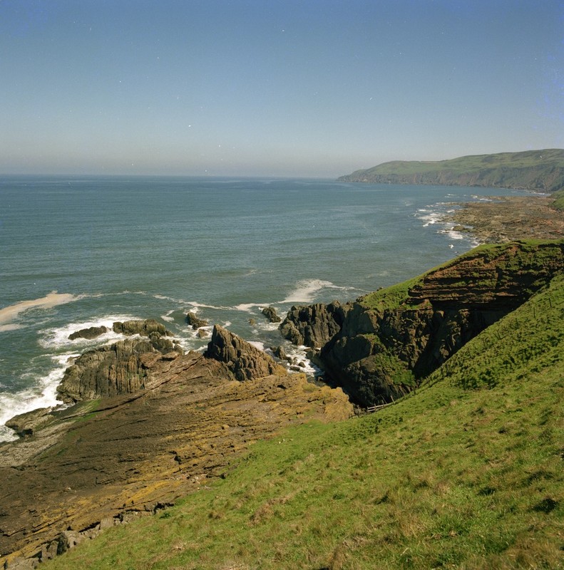
| 09:15, 20 October 2015 | P000823.jpg (file) |  |
184 KB | JenniferFindlay1 | Siccar Point, eastward view. Berwickshire. Unconformity between Upper Old Red Sandstone and the underlying Silurian (Llandovery) age rocks. Dark red sandstones and breccias of the Upper Old Red Sandstone age dip at low angles to the north and rest unco... | 1 |
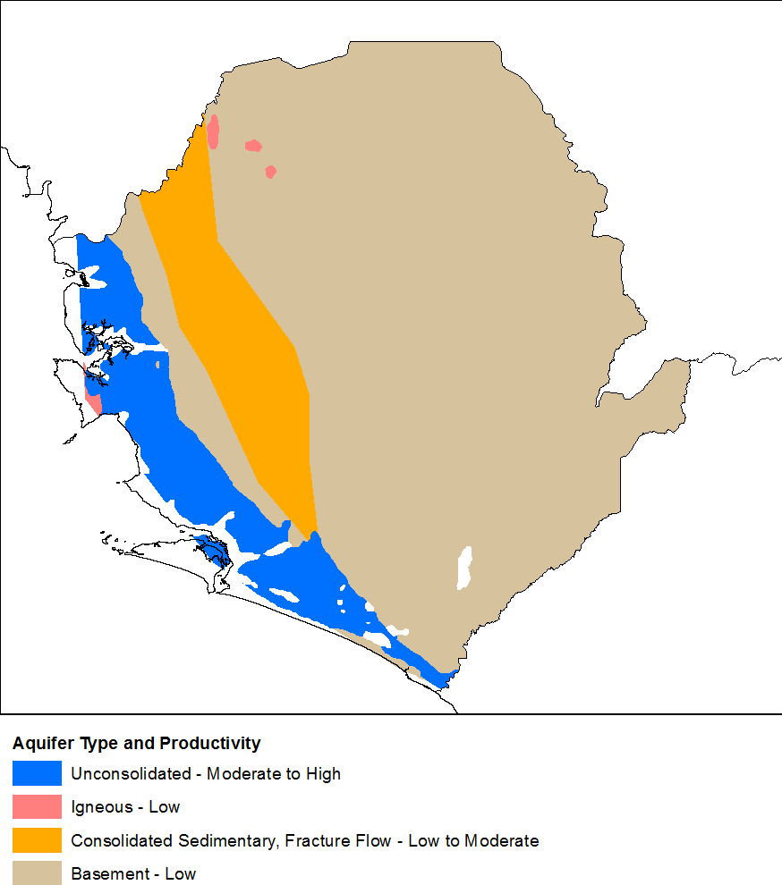
| 16:54, 13 October 2015 | Sierra Leone Hydrogeology2.png (file) |  |
25 KB | Beod | 1 | |
| 09:50, 13 October 2015 | P008512.jpg (file) |  |
193 KB | JenniferFindlay1 | West Tarbet, Mull of Galloway. Steeply-plunging minor folds in greywackes of the Hawick Group, Silurian. P008512 | 1 |
| 09:43, 13 October 2015 | P521155.jpg (file) |  |
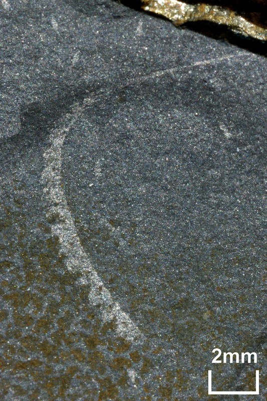
192 KB | JenniferFindlay1 | A fossil specimen of Monograptus limatulus. A fossil graptolite. (Graptolithina.) Clanyard Bay, south side, Wigtownshire, Scotland. This specimen of Monograptus limatulus is from the convolutus Biozone of the Silurian and was found on the south side of... | 1 |
| 09:31, 13 October 2015 | P008467.jpg (file) |  |
178 KB | JenniferFindlay1 | Port Logan, sea cliffs on S. side of bay. Tertiary dolerite dyke. Cuts orthogonally across thin greywacke beds of the Lower Silurian Port Logan Formation. Greywackes are vertical, strike 060 degrees south-east. Dyke trends north-west to south-east. P00... | 1 |
| 09:22, 13 October 2015 | P008490.jpg (file) |  |
191 KB | JenniferFindlay1 | S. side of The Hoolies, Ardwell Bay. Steeply-plunging fold in thin-bedded greywackes of the Garheugh Formation, Silurian. P008490 | 1 |
| 09:14, 13 October 2015 | P008482.jpg (file) |  |
207 KB | JenniferFindlay1 | Ardwell Bay, N. side. Anticline in greywackes of the Garheugh Formation, Silurian. Fold hinge plunges gently south-west. P008482 | 1 |
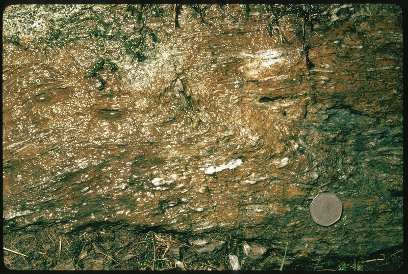
| 08:58, 13 October 2015 | P552675.jpg (file) |  |
206 KB | JenniferFindlay1 | North Greens (No. 2) Limestone. Bents Quarry, 600 yards north of Macbiehill House. Peebles. Fawn-grey, compact limestone composed of fragments of crinoids, shells and polyzoa in a turbid base partly of granular calcareous debris, partly pelitomorphic c... | 1 |
| 12:40, 6 October 2015 | P008429.jpg (file) |  |
180 KB | JenniferFindlay1 | Portpatrick Quarry. Monocline in greywackes. The attitude of the Portpatrick Formation greywackes changes from sub-horizontal at the top of the cliff to vertical at the base. P008429 | 1 |
| 12:31, 6 October 2015 | P008516.jpg (file) |  |
194 KB | JenniferFindlay1 | Killantringan Bay. Synclinal fold hinge in greywackes of the Portpatrick Formation, Ordovician. P008516 | 1 |
| 12:10, 6 October 2015 | P509358.jpg (file) |  |
201 KB | JenniferFindlay1 | Well-developed rodding in greywacke associated with the Moniaive Shear Zone, Dalry from Corriedoo Forest Road. P509358 | 1 |
| 12:01, 6 October 2015 | P008450.jpg (file) |  |
277 KB | JenniferFindlay1 | Murray's Monument, A712 Newton Stewart to New Galloway Road. Foliated meta-greywacke. Steeply plunging dextral kink band in foliated meta-greywacke with fine quartz veins parallel to fabric. Cairnsmore of Fleet granite aureole. P008450 | 1 |
| 11:56, 6 October 2015 | P008445.jpg (file) |  |
221 KB | JenniferFindlay1 | Wood of Dervaird, 2 km. E. of Glenluce. Sinistral fold pair in cleaved and veined siltstone. View down hinges of steeply-plunging sinistral fold pair which deforms cleavage and fine veins and knots of quartz in a fault zone. P008445 | 1 |
| 11:51, 6 October 2015 | P248524.jpg (file) |  |
186 KB | JenniferFindlay1 | Talnotry, NE of Newton Stewart. Junction of Cairnsmore-of-Fleet granite with overlying Silurian grit. P248524 | 1 |
| 11:41, 6 October 2015 | P527792.jpg (file) |  |
178 KB | JenniferFindlay1 | Limestone from Bent's Quarry, Macbiehill, Peeblesshire. A medium-grained limestone containing a few what are though to be crinoids weathering to pale brown from Bent's Quarry, 700 yards south of Macbiehill, Peeblesshire. Macbiehill Quarry is in close p... | 1 |
| 11:22, 6 October 2015 | P509338.jpg (file) |  |
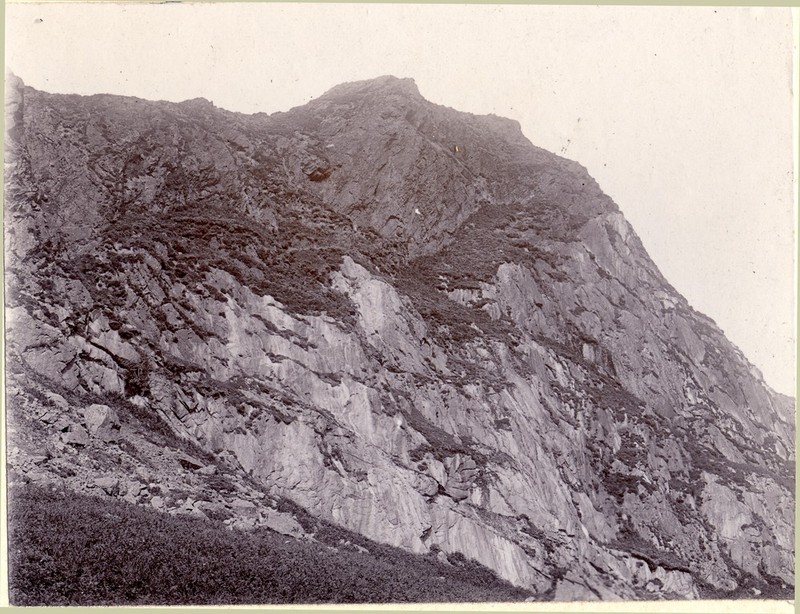
120 KB | JenniferFindlay1 | Loch Doon, Ayrshire/Kirkcudbrightshire border. Looking south-south-east from dam. Black Craig in centre with Coran of Portmark, then Boe, then Meaul, and then Carlins Cairn to the right. P509338 | 1 |
| 10:55, 6 October 2015 | P266685.jpg (file) |  |
123 KB | JenniferFindlay1 | Leadhills, Lanarkshire. Manner' Scar, Susanna Vein. P266685 | 1 |
| 08:58, 6 October 2015 | P220174.jpg (file) |  |
202 KB | JenniferFindlay1 | Penton Linns, Liddell Water, 2.5 m. ENE of Canonbie. Steeply-dipping limestones (Upper Liddlesdale Group). P220174 | 1 |
| 08:47, 6 October 2015 | P220173.jpg (file) |  |
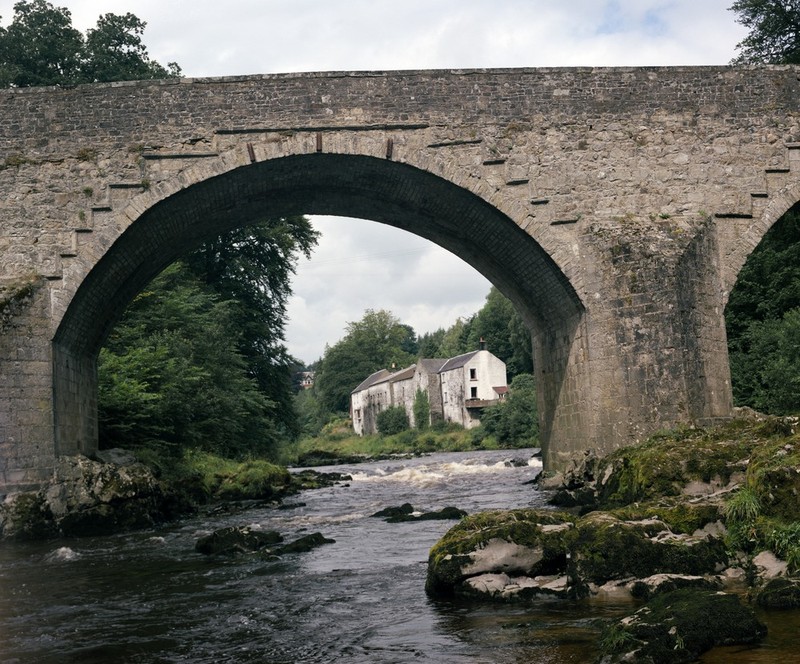
195 KB | JenniferFindlay1 | River Esk, Skipper's Bridge, Langholm. Birrenswark Lavas, forming the foundations for Skipper's Bridge, Langholm. P220173 | 1 |
| 08:39, 6 October 2015 | P218294.jpg (file) |  |
159 KB | JenniferFindlay1 | Pedens View Quarry, 2.6 km. NW of Langholm. Groove casts, bifurcating and groove in groove structure. | 1 |
| 08:33, 6 October 2015 | P218281.jpg (file) |  |
185 KB | JenniferFindlay1 | Peden's View Quarry, 2.6 km. NW of Langholm. Tight fold in massive and flaggy greywackes. P218281 | 1 |
| 16:06, 1 October 2015 | 15007fig20.jpg (file) |  |
150 KB | Dbk | User created page with UploadWizard | 1 |
| 16:06, 1 October 2015 | 15007fig19.jpg (file) |  |
271 KB | Dbk | User created page with UploadWizard | 1 |
| 16:06, 1 October 2015 | 15007fig16.jpg (file) |  |
73 KB | Dbk | User created page with UploadWizard | 1 |
| 16:06, 1 October 2015 | 15007fig18.jpg (file) |  |
72 KB | Dbk | User created page with UploadWizard | 1 |
| 16:06, 1 October 2015 | 15007fig14.jpg (file) |  |
75 KB | Dbk | User created page with UploadWizard | 1 |
| 16:06, 1 October 2015 | 15007fig13.jpg (file) |  |
148 KB | Dbk | User created page with UploadWizard | 1 |
| 16:06, 1 October 2015 | 15007fig12.jpg (file) |  |
74 KB | Dbk | User created page with UploadWizard | 1 |
| 16:06, 1 October 2015 | 15007fig11.jpg (file) |  |
70 KB | Dbk | User created page with UploadWizard | 1 |
| 16:06, 1 October 2015 | 15007fig10.jpg (file) |  |
302 KB | Dbk | User created page with UploadWizard | 1 |
| 16:06, 1 October 2015 | 15007fig9.jpg (file) |  |
71 KB | Dbk | User created page with UploadWizard | 1 |
| 16:06, 1 October 2015 | 15007fig8.jpg (file) |  |
78 KB | Dbk | User created page with UploadWizard | 1 |
| 16:06, 1 October 2015 | 15007fig7.jpg (file) |  |
70 KB | Dbk | User created page with UploadWizard | 1 |
| 16:06, 1 October 2015 | 15007fig6.jpg (file) |  |
78 KB | Dbk | User created page with UploadWizard | 1 |
| 16:06, 1 October 2015 | 15007fig5.jpg (file) |  |
71 KB | Dbk | User created page with UploadWizard | 1 |