File list
Jump to navigation
Jump to search
This special page shows all uploaded files.
| Date | Name | Thumbnail | Size | User | Description | Versions |
|---|---|---|---|---|---|---|
| 09:57, 19 May 2014 | P841815.jpg (file) |  |
377 KB | Dbk | Wales topography and place names. | 1 |
| 09:53, 19 May 2014 | P859258.jpg (file) |  |
180 KB | Dbk | Distribution of water boreholes recorded by BGS/EA | 1 |
| 09:51, 19 May 2014 | P841814.jpg (file) |  |
205 KB | Dbk | Solid geology in Wales. | 1 |
| 09:07, 19 May 2014 | P807822.jpg (file) |  |
48 KB | Dbk | chematic section showing the relationship of Quaternary deposits. | 1 |
| 09:03, 19 May 2014 | P785772.jpg (file) |  |
467 KB | Dbk | Views of Bury Hill Quarry Seaford and Newhaven Chalk Formations. View of the quarry on the north side of Bury Hill (Quarry) off Foundary Road Anna Valley, near Andover. The quarry exposes the higher part of the Seaford Chalk Formation characterised by ... | 1 |
| 09:02, 19 May 2014 | P775267.jpg (file) |  |
238 KB | Dbk | View of Highclere Castle. | 1 |
| 09:01, 19 May 2014 | P670041.jpg (file) |  |
212 KB | Dbk | New Pit Chalk at Laundry Cottages, Sydmonton. New cut for barn within old quarry shows massive firm to moderately hard smooth white chalk with marls overlain by rubbly chalk brash. Hammer 28 cms. Close up of anastomosing marl complex. | 1 |
| 09:01, 19 May 2014 | P670000.jpg (file) |  |
218 KB | Dbk | Portridge House quarry ,Burghclere, Chalk Rock. Steeply dipping nodular chalks, hardgrounds and flints of the Chalk Rock Member, Lewes Nodular Chalk Formation on northern limb of Kingsclere Anticline. The Burghclere pit of Bromley and Gale and Brydones... | 1 |
| 09:00, 19 May 2014 | P815491.jpg (file) |  |
192 KB | Dbk | Illustration of the Chalk Group correlation for the Southern Chalk Province. | 1 |
| 08:55, 19 May 2014 | P807821.jpg (file) |  |
167 KB | Dbk | Location of key deep hydrocarbons boreholes in the Andover district and adjacent areas. | 1 |
| 08:53, 19 May 2014 | P807820.jpg (file) |  |
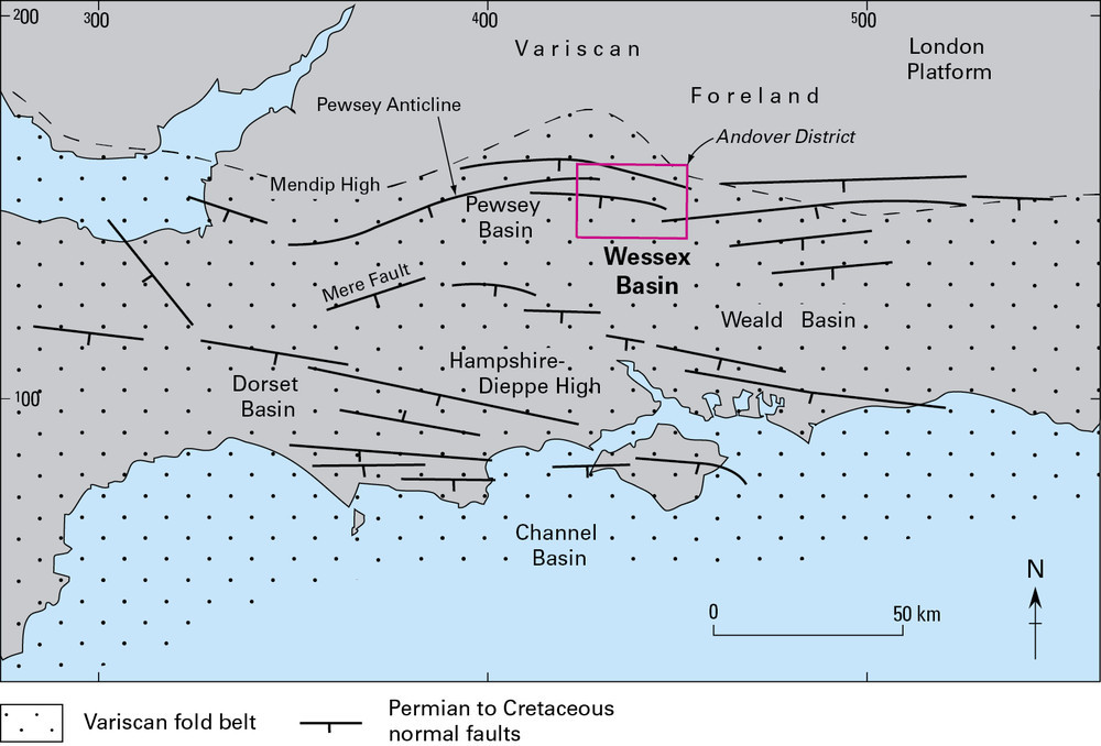
126 KB | Dbk | Major structures of southern England and locations of the Andover district. | 1 |
| 08:30, 19 May 2014 | P807823.jpg (file) |  |
221 KB | Dbk | Geological succession of the Andover area. From Andover Sheet Explanation. | 1 |
| 08:29, 19 May 2014 | P807819.jpg (file) |  |
269 KB | Dbk | Andover district and bedrock geology. | 1 |
| 14:40, 16 May 2014 | Join.png (file) |  |
33 KB | Dbk | 2 | |
| 12:25, 16 May 2014 | Firefox chrome.png (file) |  |
134 KB | Dbk | 1 | |
| 12:16, 16 May 2014 | Edit-icon.png (file) | 13 KB | Dbk | 1 | ||
| 14:56, 14 May 2014 | P219228.jpg (file) |  |
124 KB | Dbk | Ballagan Burn, 1.2 km. E. of Strathblane. Alternating bands of mudstone and cementstone. Ballagan Beds of Lower Carboniferous age. | 1 |
| 14:55, 14 May 2014 | P213679.jpg (file) |  |
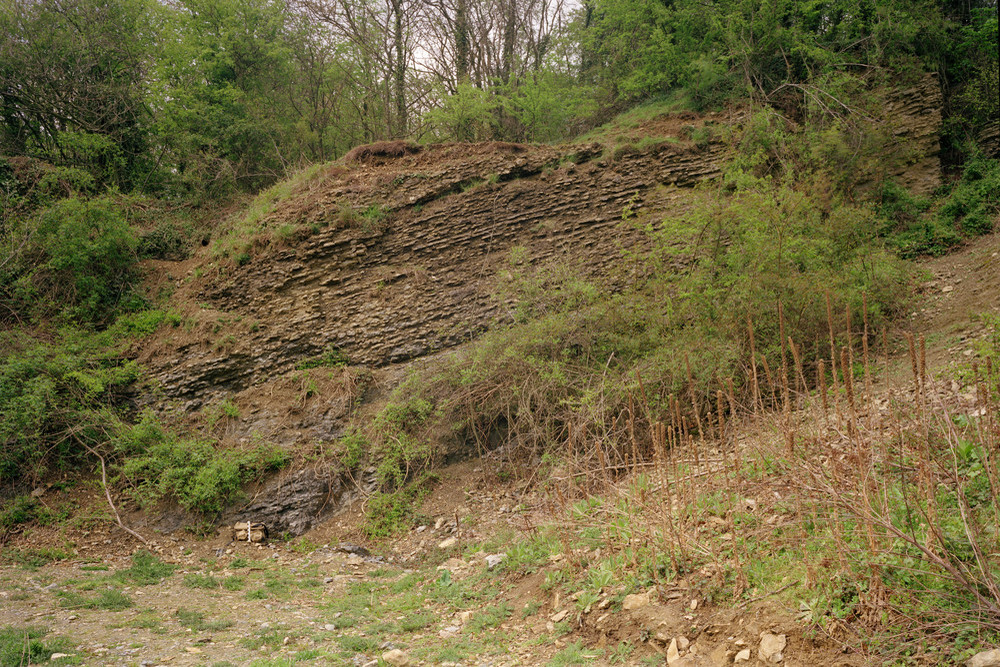
426 KB | Dbk | Vinesend Quarry. Much Wenlock Limestone Formation. View of west-dipping thinly-bedded to nodular-bedded limestone and shales. | 1 |
| 14:54, 14 May 2014 | P213293.jpg (file) |  |
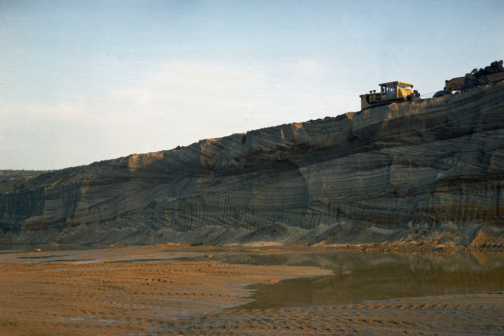
201 KB | Dbk | Looking south-east at the working face of quarry in Woburn Sands (Lower Cretaceous). Pratts Quarry, Joseph Arnold and Sons Ltd., Leighton Buzzard. This quarry south of Leighton Buzzard exploits the 'Red Sands' at the top of the Woburn Sands sequence. U... | 1 |
| 14:54, 14 May 2014 | P213128.jpg (file) |  |
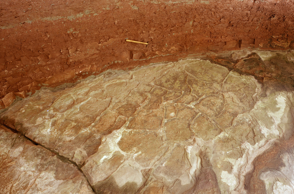
287 KB | Dbk | Waterfall in stream gulley, 750 m. at 278 degrees from Bilfield Farm. Dessication crack casts on the sole of a sandstone in the St. Maughan's Formation. Upward view of the base of a sandstone bed forming a prominent undercut waterfall. Sand has infille... | 1 |
| 14:53, 14 May 2014 | P212915.jpg (file) |  |
208 KB | Dbk | Canon Bridge, Hereford. Kettle hole in glacial moraine. The Canon Bridge area is underlain by gravels of the Devensian Kettle Moraine. This gives rise to a moundy topography with abundant kettle holes caused by the melting of sub-surface ice. | 1 |
| 14:52, 14 May 2014 | P212583.jpg (file) |  |
551 KB | Dbk | Shrewley Canal cutting, c. 150 m. north-west of the tunnel portal. Basal beds of Arden Sandstone at type locality. The highest beds shown are interbedded mudstones, siltstones and sandstones, the latter being more resistant and predominantly lenticular... | 1 |
| 13:49, 11 February 2014 | P895005.png (file) |  |
666 KB | Dbk | The development of the terminology in the Southern Province. | 1 |
| 09:14, 14 October 2013 | Cnip.jpg (file) |  |
2.72 MB | Anapier | 1 |