Uploads by Scotfot
Jump to navigation
Jump to search
This special page shows all uploaded files.


| Date | Name | Thumbnail | Size | Description | Versions |
|---|---|---|---|---|---|
| 23:59, 29 June 2022 | 19750611.jpg (file) |  |
1.18 MB | Example BGS fieldslip for Sutherland 71 NW. This is a quarter of a six inch to the mile full sheet. Front. | 1 |
| 23:40, 29 June 2022 | BGS 19702048.jpg (file) |  |
1.12 MB | British Geological Survey example field slip SH45SE/NE in Gwynedd. Surveyed by C.J.N. Fletcher 1980. Back. Exceptionally detailed notes relating to sites numbered on the front of the fieldslip. | 1 |
| 23:39, 29 June 2022 | BGS 19702047.jpg (file) |  |
1.29 MB | British Geological Survey example field slip SH45SE/NE in Gwynedd. Surveyed by C.J.N. Fletcher 1980. Front. | 1 |
| 21:36, 18 June 2022 | BGS AGM Map.jpg (file) |  |
685 KB | Index to areas covered by Applied Geology Maps, 22 May 1997. From: Applied Geology Mapping: a catalogue of the available maps and reports. | 1 |
| 13:29, 4 May 2022 | GAGreenAlbumV2.jpg (file) |  |
502 KB | Sample page from Geologists' Association 'Green' album of group photographs taken on excursions. | 1 |
| 13:13, 4 May 2022 | GA GreenAlbum.jpg (file) |  |
245 KB | A sample page from the Geologists' Association 'green' album of portraits and group photographs. | 1 |
| 09:45, 13 April 2022 | GA Image 0500.jpg (file) |  |
197 KB | Figure 66 Diagram-Section through Watford and Bushey (Length about 6 miles) 1 Alluvium. 2. Gravel, Glacial Drift. 2′. Brick-earth, Glacial Drift. 3. Pebble Gravel. 4. London Clay. 5 Woolwich and Reading Beds. 6 Chalk with Flints. {{Template:GA excursions1860-1890}} == Licencing == {{GA}} | 1 |
| 09:45, 13 April 2022 | GA Image 0499.jpg (file) |  |
395 KB | Figure 65 Watford Heath Kiln. a. Brown Clay. b. Brown sandy Clay, with Shells. c. Pebble-bed (Fossils at Watford). d. Brown sandy Clay, with Sandstone. e. Flint Pebbles, with Fossils. [London Clay.] f Coloured Clays. g. Light coloured Sand. h. Sand, with Pebbles. i. Sand and Loam. j. Flints in Sand. [Reading Beds.] l. Chalk, with Flints. [These two blocks kindly lent by the Herts. Nat. Hist. Soc.] {{Template:GA excursions1860-1890}} == Licencing == {{GA}} | 1 |
| 09:44, 13 April 2022 | GA Image 0498.jpg (file) |  |
389 KB | Figure 64 Bushey Kiln. [These two blocks kindly lent by the Herts. Nat. Hist. Soc.] {{Template:GA excursions1860-1890}} == Licencing == {{GA}} | 1 |
| 09:43, 13 April 2022 | GA Image 0497.jpg (file) |  |
241 KB | Figure 63 Section along the new line from Pinner to Rickmansworth.. The level of the line is approximately (from Aneroid measurements) 190 feet above ordnance datum at Pinner, 230 feet at the highest point near Grove Green, and 200 feet at Moor Farm. a. Alluvium. b. Brick Earth. c. London Clay. d. Reading Beds. e. Chalk. {{Template:GA excursions1860-1890}} == Licencing == {{GA}} | 1 |
| 18:29, 12 April 2022 | GA Image 0496.jpg (file) |  |
510 KB | Figure 62 Section at the Mount, Ealing. (About 50 feet long * Included mass of sand. ** included deposits of Purple Clay. {{Template:GA excursions1860-1890}} == Licencing == {{GA}} | 1 |
| 18:25, 12 April 2022 | GA Image 0495.jpg (file) |  |
495 KB | Figure 61.—The Mount, Ealing. Excavation of the south side, October 1882. {| class="wikitable" | S Surface soils full of stones || ¾ |- | A. Mottled Clay "puddled" || 2–3 |- | B. Channel filled with gravel, stones, clay (some probably 130-150 ft. long) || 3–5 |- | C.Laminated loamy clay with sand, drippinf slightly S. || 5 |- | D. very loamy clay, with sandy layers, mica and sarsens || |- | E. Strong loamy clay with mica || |} {{Template:GA excursions1860-1890}} == Licencing == {{GA}} | 1 |
| 18:22, 12 April 2022 | GA Image 0494.jpg (file) |  |
177 KB | Figure 60 Section from Pinner to Hampstead (1 inch to 2 miles) By J.L. Lobley. 1. Chalk. 2. Woolwich Beds. 3. London Clay. 3′ Upper Sandy London Clay. 4 Bagshot Sands. 5 Hill Gravels (?Glacial). 6 Brent Gravels (Post Pliocene Alluvium). {{Template:GA excursions1860-1890}} == Licencing == {{GA}} | 1 |
| 18:21, 12 April 2022 | GA Image 0493.jpg (file) |  |
123 KB | Figure 59 At depths of 20 feet, and sometimes 30 feet, other gravel occurs with still older, more greatly abraded, and ochreous implements ; one of which, from the east side of the Lea, at Leyton, Essex, is illustrated at Figure 59. Reproduced here by the kind. permission of Mr. Worthington G.. Smith, F.L.S. {{Template:GA excursions1860-1890}} == Licencing == {{GA}} | 1 |
| 18:20, 12 April 2022 | GA Image 0492.jpg (file) |  |
391 KB | Figure 58 The implements from the twelve-foot stratum of Thames gravel are sub-abraded, lustrous and of greater age than the foregoing ; one of these, now in the collection of Dr. Evans, is illustrated, one-half real size, by Figure 58. Reproduced here by the kind. permission of Mr. Worthington G.. Smith, F.L.S. {{Template:GA excursions1860-1890}} == Licencing == {{GA}} | 1 |
| 18:20, 12 April 2022 | GA Image 0491.jpg (file) |  |
54 KB | Figure 57 Abraded quartz hammer-stone. Reproduced here by the kind. permission of Mr. Worthington G.. Smith, F.L.S. {{Template:GA excursions1860-1890}} == Licencing == {{GA}} | 1 |
| 18:18, 12 April 2022 | GA Image 0490.jpg (file) |  |
84 KB | Figure 56 Small and beautifully-made flint implement. Reproduced here by the kind. permission of Mr. Worthington G.. Smith, F.L.S. {{Template:GA excursions1860-1890}} == Licencing == {{GA}} | 1 |
| 18:18, 12 April 2022 | GA Image 0489.jpg (file) |  |
110 KB | Figure 55 Small and beautifully-made flint implement. Reproduced here by the kind. permission of Mr. Worthington G.. Smith, F.L.S. {{Template:GA excursions1860-1890}} == Licencing == {{GA}} | 1 |
| 18:17, 12 April 2022 | GA Image 0488.jpg (file) |  |
546 KB | Figure 54 Section showing "Warp and Trail", Stoke Newington.. Reproduced here by the kind. permission of Mr. Worthington G.. Smith, F.L.S. {{Template:GA excursions1860-1890}} == Licencing == {{GA}} | 1 |
| 18:16, 12 April 2022 | GA Image 0487.jpg (file) |  |
570 KB | Figure 53 Section west of Kyverdale Road, Stoke Newington. Reproduced here by the kind. permission of Mr. Worthington G.. Smith, F.L.S. {{Template:GA excursions1860-1890}} == Licencing == {{GA}} | 1 |
| 18:15, 12 April 2022 | GA Image 0486.jpg (file) |  |
873 KB | Figure 52 Section in Stoke Newington Pit [Reprinted by permission of the Council from Q.J.G.S vol. xxvi. Surface Soil. k. Covering bed, large flints in stiff brown clay. ? Trail] 6-8 feet. j. Brick-earth. 2.-g., e.-c. Finely laminated loams and clays. f. Peaty black clay. Beds c.-j. were 30 feet thick. {{Template:GA excursions1860-1890}} == Licencing == {{GA}} | 1 |
| 18:14, 12 April 2022 | GA Image 0485.jpg (file) |  |
178 KB | Figure 51 Section across the valleys of the Hackney Brook and the Lea. A Ayrsome Street. B. Stoke Newington Common. C. Stamford Hill. a. Gravels. b. London Clay {{Template:GA excursions1860-1890}} == Licencing == {{GA}} | 1 |
| 18:13, 12 April 2022 | GA Image 0484.jpg (file) |  |
329 KB | Figure 50 Vertical sections of the gravels of Hackney. {{Template:GA excursions1860-1890}} == Licencing == {{GA}} | 1 |
| 00:03, 6 April 2022 | GA Image 0483.jpg (file) |  |
196 KB | Figure 49 Section along the cliffs of Hastings and Fairlight. {{Template:GA excursions1860-1890}} = Licencing == {{GA}} | 1 |
| 22:28, 5 April 2022 | GA Image 0481.jpg (file) |  |
214 KB | Figure 47 Section of the southern valley of the Weald (Length of section about 4 miles) Vertical scale greatly exaggerated. {{Template:GA excursions1860-1890}} = Licencing == {{GA}} | 1 |
| 12:05, 22 March 2022 | BellinghamIndexto10kmaps.JPG (file) |  |
85 KB | Bellingham Sheet 13. Index map of available Geological Survey Six-Inch National Grid Maps. | 1 |
| 11:14, 22 March 2022 | 1001481 2000.jpg (file) |  |
1.35 MB | Bellingham Sheet 13 Geological Survey of Great Britain, England and Wales 1:50,000 map. Solid Edition. https://largeimages.bgs.ac.uk/iip/mapsportal.html?id=1001481 Full resolution version | 1 |
| 11:13, 22 March 2022 | 1001480 2000.jpg (file) |  |
1.35 MB | Bellingham Sheet 13 Geological Survey of Great Britain, England and Wales 1:50,000 map. Drift Edition. https://largeimages.bgs.ac.uk/iip/mapsportal.html?id=1001480 Full resolution version | 1 |
| 11:05, 6 March 2022 | P710267.jpg (file) |  |
161 KB | Operator sitting at a IBM 1130 minicomputer. Computer Unit, Exhibition Road, Institute of Geological Sciences. | 1 |
| 11:04, 6 March 2022 | P710266.jpg (file) |  |
163 KB | Operator sitting at a IBM 1130 minicomputer. Computer Unit, Exhibition Road, Institute of Geological Sciences. | 1 |
| 11:03, 6 March 2022 | P710265.jpg (file) |  |
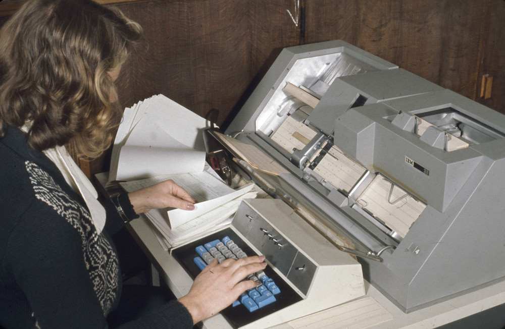
144 KB | IBM punched card input machine. Computer Unit, Exhibition Road, Institute of Geological Sciences. | 1 |
| 11:03, 6 March 2022 | P710264.jpg (file) |  |
144 KB | IBM punched card input machine. Computer Unit, Exhibition Road, Institute of Geological Sciences. | 1 |
| 11:02, 6 March 2022 | P710263.jpg (file) |  |
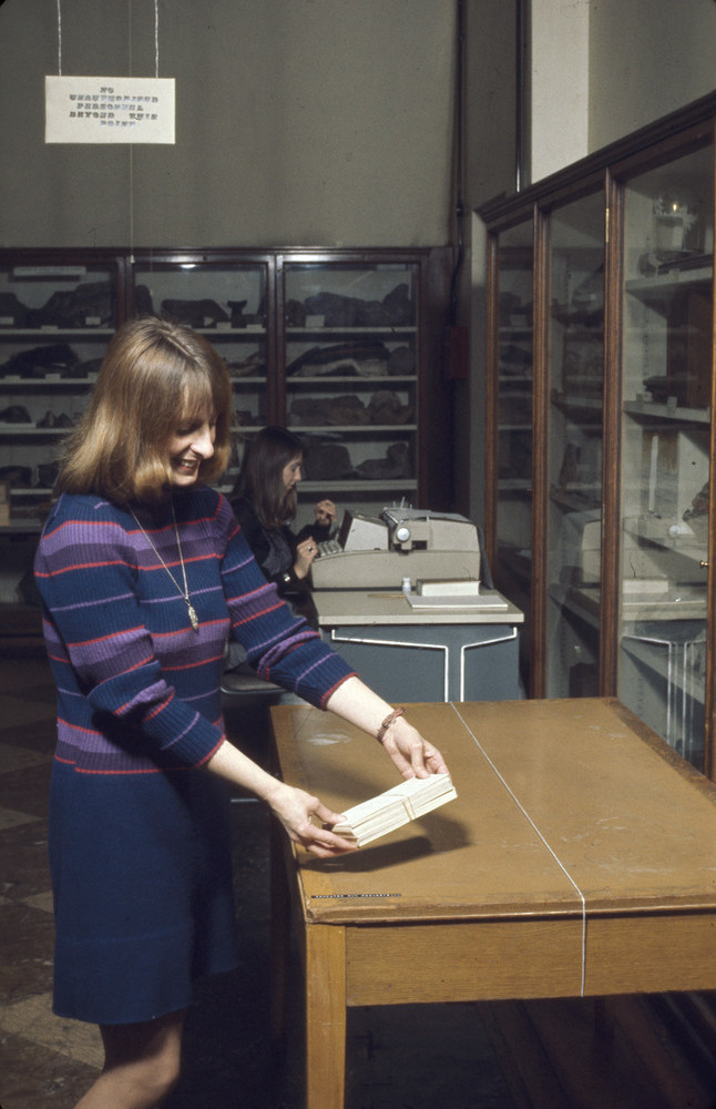
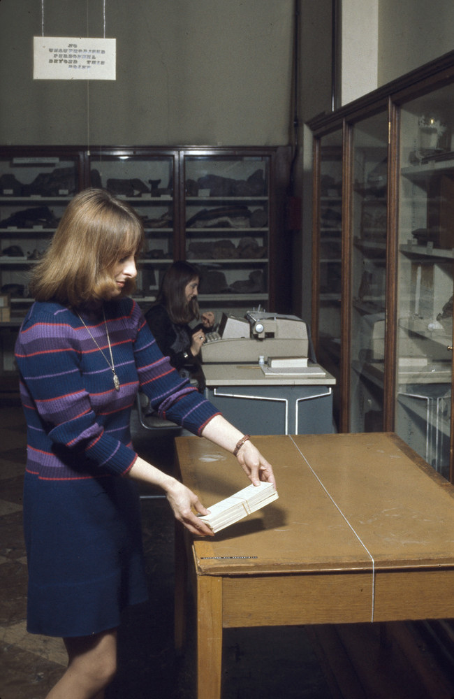
153 KB | Punched card jobs. Computer Unit, Exhibition Road, Institute of Geological Sciences. | 1 |
| 11:02, 6 March 2022 | P710262.jpg (file) |  |
151 KB | Punched card jobs. Computer Unit, Exhibition Road, Institute of Geological Sciences. | 1 |
| 11:00, 6 March 2022 | P710261.jpg (file) |  |
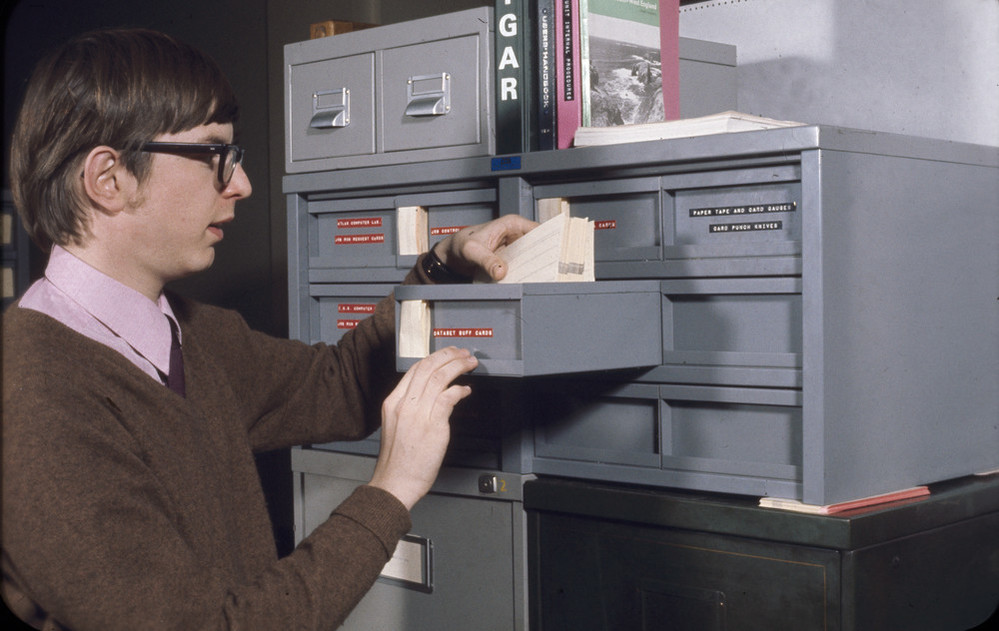
145 KB | Punched card storage trays. Computer Unit, Exhibition Road, Institute of Geological Sciences. | 1 |
| 11:00, 6 March 2022 | P710260.jpg (file) |  |
140 KB | Punched card storage trays. Computer Unit, Exhibition Road, Institute of Geological Sciences. | 1 |
| 10:58, 6 March 2022 | P710259.jpg (file) |  |
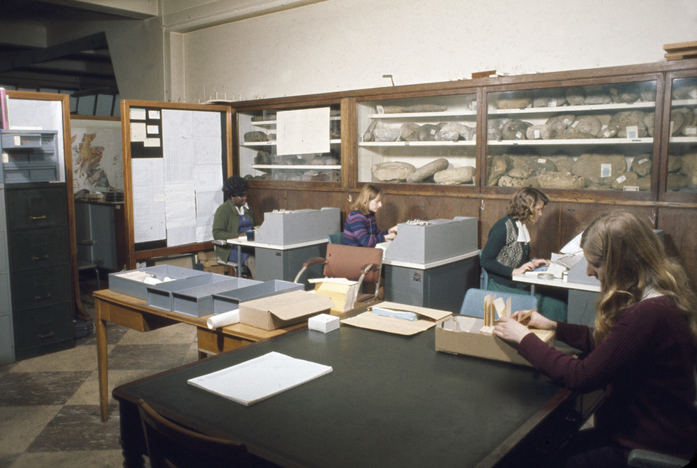
180 KB | Computer Unit. Three keypunch operators | 1 |
| 10:58, 6 March 2022 | P710258.jpg (file) |  |
173 KB | Keypunch machine. Computer Unit, Exhibition Road, Institute of Geological Sciences. | 1 |
| 10:57, 6 March 2022 | P710257.jpg (file) |  |
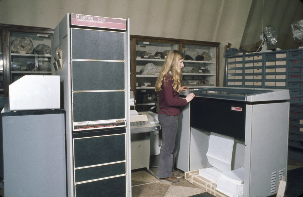
158 KB | The Digital PDP-11 computer and fanfold paper printer. Computer Unit, Exhibition Road, Institute of Geological Sciences. | 1 |
| 10:57, 6 March 2022 | P710256.jpg (file) |  |
137 KB | Punched card machine (Verifier?). Computer Unit, Exhibition Road, Institute of Geological Sciences. | 1 |
| 10:56, 6 March 2022 | P710255.jpg (file) |  |
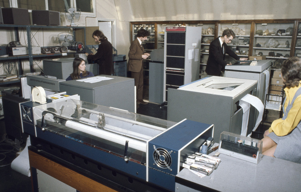
183 KB | Computer Unit. Plotter, two fanfold printers. The tall cabinet is the PDP-11 computer. Computer Unit, Exhibition Road, Institute of Geological Sciences. | 1 |
| 10:55, 6 March 2022 | P710254.jpg (file) |  |
172 KB | Computer Unit. Three keypunch operators. Computer Unit, Exhibition Road, Institute of Geological Sciences. | 1 |
| 10:53, 6 March 2022 | P710253.jpg (file) |  |
147 KB | Inserting a disk cartridge. Computer Unit, Exhibition Road, Institute of Geological Sciences. | 1 |
| 10:51, 6 March 2022 | P710252.jpg (file) |  |
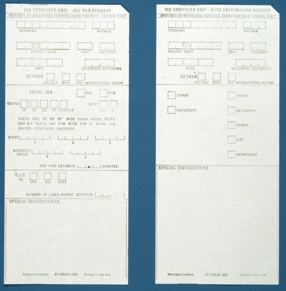
263 KB | Job run request card. Computer Unit, Exhibition Road, Institute of Geological Sciences. | 1 |
| 10:50, 6 March 2022 | P710251.jpg (file) |  |
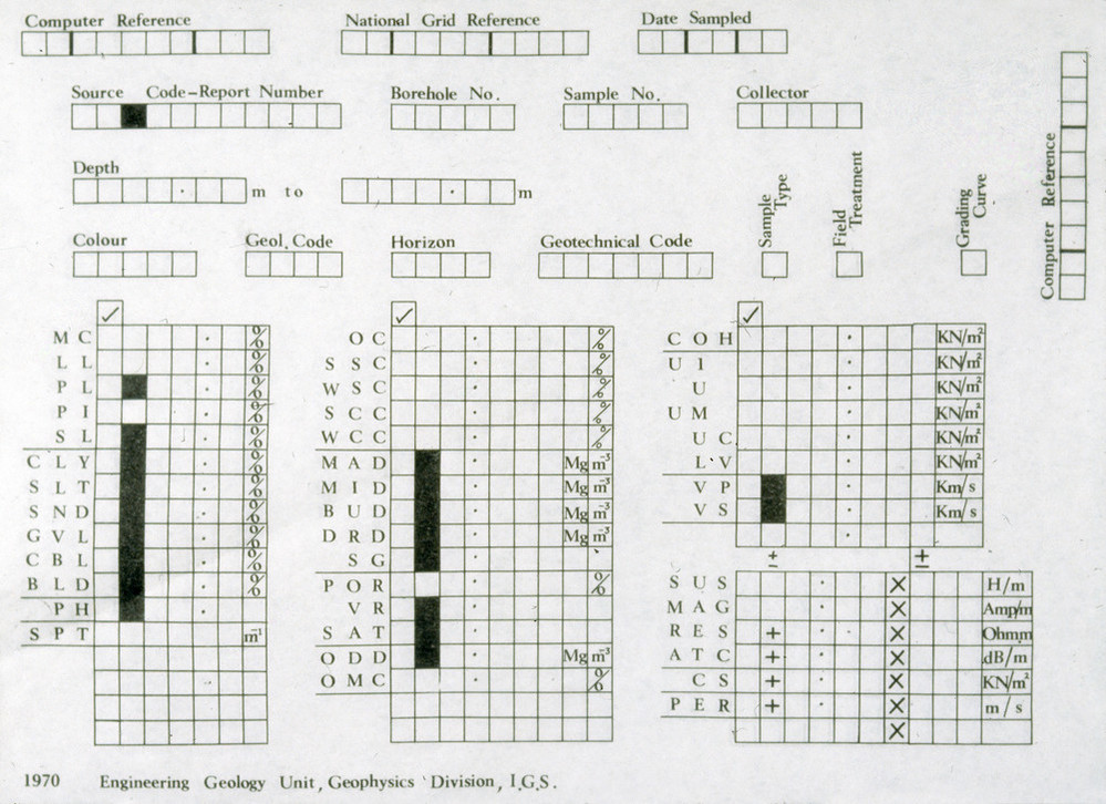
205 KB | Engineering Geology Unit input form. Computer Unit, Exhibition Road, Institute of Geological Sciences. | 1 |
| 10:49, 6 March 2022 | P710250.jpg (file) |  |
212 KB | Engineering Geology Unit input form. Computer Unit, Exhibition Road, Institute of Geological Sciences. | 1 |
| 10:48, 6 March 2022 | P710249.jpg (file) |  |
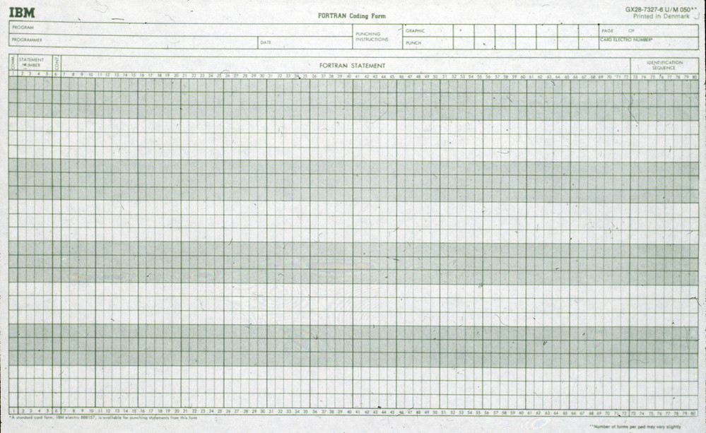
213 KB | Fortran Coding Form. Computer Unit, Exhibition Road, Institute of Geological Sciences. | 1 |
| 10:47, 6 March 2022 | P710248.jpg (file) |  |
281 KB | Petrographical data input sheet. Computer Unit, Exhibition Road, Institute of Geological Sciences. | 1 |
| 10:56, 5 March 2022 | P008939.jpg (file) |  |
159 KB | Institute of Geological Sciences Computer Unit staff. Taken in the Reserve and study gallery of the Geological Museum, Exhibition Road. Including visiting staff from Murchison House and Dr. Henley from Keyworth. Left to right, top row M.F. Horder, D.G. Farmer, G.G. Baxter, A.J.H. Redman, J.F. Wheeler, J. Hargreaves, T.V. Loudon, P.L. Hunt, C.B. Jones, S. Henley. Left to right, lower row G.E. Pickup, M.A. Register, H.A. Phelan, L.D. Kinnaird, A.L. Macintosh, C. Steven. The twins on the lower l... | 1 |
| 21:15, 4 March 2022 | LoudonScenarioFrontCover.JPG (file) |  |
55 KB | A scenario for systems geology: suggestions concerning the emerging geoscience knowledge system and the future geological map. BGS Research Report RR/11/05. Front cover. | 1 |