Category:Coasts and estuaries geohazards
About
This category is provided to highlight content from the BGS coasts and estuaries geohazards team[1]
BGS coasts and estuaries geohazards team provides independent and expert geoscientific tools and advice for collaborative decision making to assess different adaptation options for coastal flooding and erosion.
The team combines the use of innovative 4D simulation models and cost-effective monitoring approaches (i.e. from space and using non-intrusive survey methods) to quantitatively assess the effects of different adaptation options against coastal flooding and coastal erosion (for example non-active intervention, managed realignment, hold the line, advance the line) with an emphasis on the transition from traditional grey engineering (such as hold the line with hard defences) to more green engineering (a combination of sand-scaping and giving space to coastal processes). The team is engaged in, and open to, collaborations with top quality academic institutions, consultants and government agencies in UK and abroad.
This Wiki is a means of stimulating the exchange of geoscience information with the wider geoscientific community which will have the opportunity to comment and contribute articles on related topics.
- Coasts and Estuaries geohazards categories on Earthwise
-
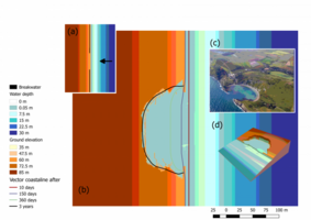
Coastal landsacape simulation via Coastal Modeling Environment (CoastalME).
-
Field observations of sediment transport on mixed sand and gravel beaches using portable Depth Integrated Streamer Trap (DIST)
-
The coastal team has contributed to the development of several toolboxes (CliffMetrics & Profile Crossings) for the System for Automated Geoscientific Analysis (SAGA)
-
The objective of this NERC highlight topic is to deliver an enhanced understanding and modelling capability of gravel barrier systems to support more sustainable coastal management (UKGravelBarrierCoasts)
Subcategories
This category has the following 4 subcategories, out of 4 total.
The number of included categories (C), pages (P) and files (F) is stated in brackets.


