Blackstones Bank Central Complex, Hebridean Igneous Province
| Emeleus, C H, and Bell, B R. 2005. British regional geology: The Palaeogene volcanic districts of Scotland. Fourth edition. Keyworth, Nottingham: British Geological Survey. |
Introduction


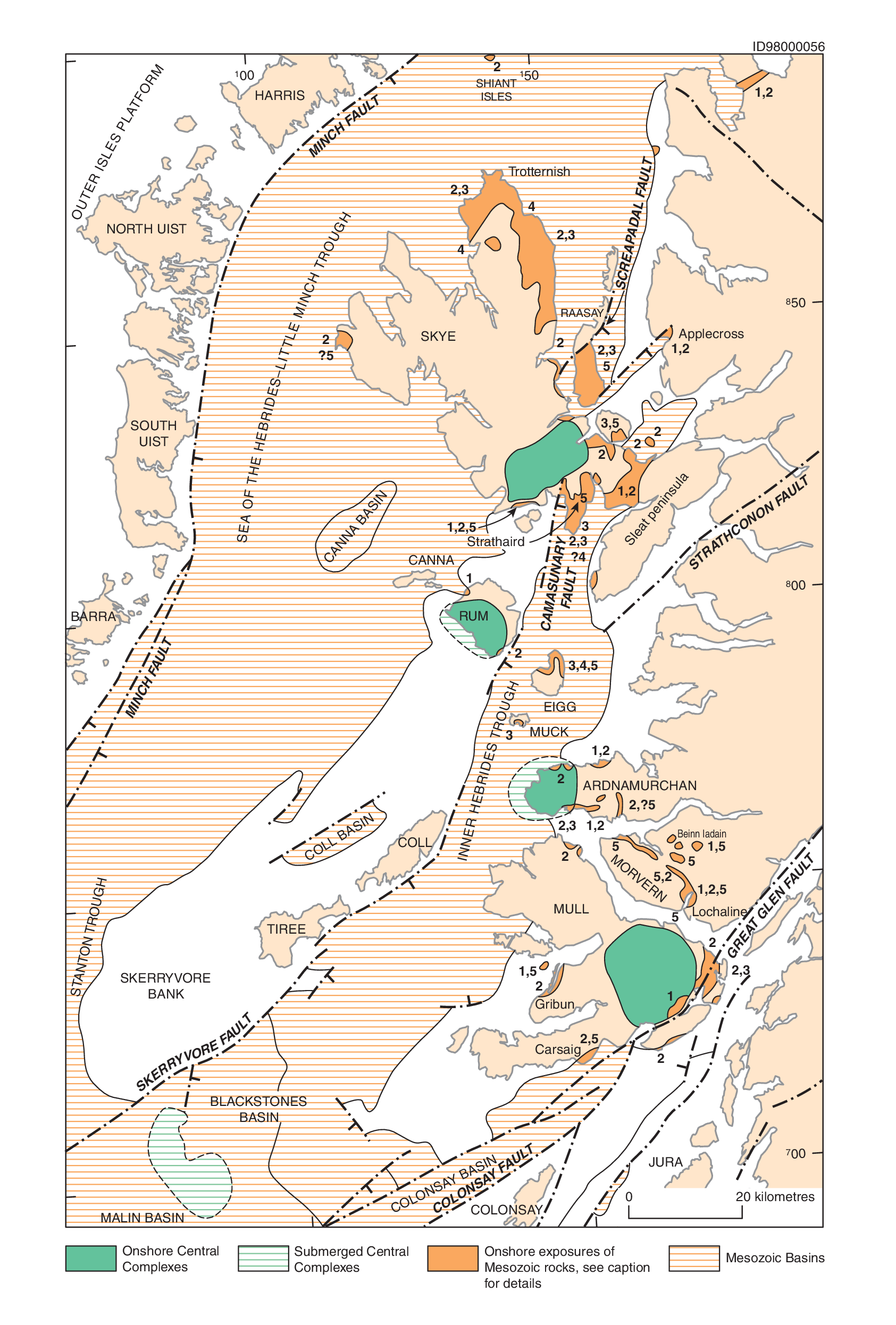
The submarine Blackstones Bank Central Complex lies within the Hebridean area (P914119, VI; P914123), about 30 km south-south-west of Tiree, and was first located by seismic, magnetic and gravity surveys (McQuillin et al., 1975; Fyfe et al., 1993). It has a rugged topography, and the shallow depths of some parts have allowed quite extensive sampling by scuba diving (Durant et al., 1976, 1982) and the construction of a geological sketch map (Fyfe et al., 1993). Most of the accessible parts are of gabbro, commonly exhibiting cumulate textures. Granophyric granite, microgranite and tuffisite samples have also been recovered together with calc-silicate hornfels. The bank is the site of both a large positive Bouguer gravity anomaly and a major magnetic anomaly. It is therefore likely that basic and ultrabasic rocks make up the bulk of the central complex, with the calc-silicate hornfels formed from the thermal alteration of the Mesozoic sedimentary rocks which it intrudes. From a geochemical study of the centre, it is inferred that the magmas interacted with crustal rocks similar to those of Proterozoic age exposed in western Islay, implying that such crust extends to the west of the Great Glen Fault (Dickin and Durant, 2002). The age of the complex is most likely Paleocene.