Hydrogeology of Liberia
Africa Groundwater Atlas >> Hydrogeology by country >> Hydrogeology of Liberia
This page has limited information and needs to be updated. If you have more information on the hydrogeology of Liberia , please get in touch!
Compilers
Dr Kirsty Upton and Brighid Ó Dochartaigh, British Geological Survey, UK
Please cite this page as: Upton & Ó Dochartaigh, 2016.
Bibliographic reference: Upton, K. & Ó Dochartaigh, B.É. 2016. Africa Groundwater Atlas: Hydrogeology of Liberia. British Geological Survey. Accessed [date you accessed the information]. http://earthwise.bgs.ac.uk/index.php/Hydrogeology_of_Liberia
Terms and conditions
The Africa Groundwater Atlas is hosted by the British Geological Survey (BGS) and includes information from third party sources. Your use of information provided by this website is at your own risk. If reproducing diagrams that include third party information, please cite both the Africa Groundwater Atlas and the third party sources. Please see the Terms and Conditions for more information.
Geographical Setting

General
| Estimated Population in 2013* | 4,294,077 |
| Rural Population (% of total) (2013)* | 51.1% |
| Total Surface Area* | 96,320 sq km |
| Agricultural Land (% of total area) (2012)* | 28.1% |
| Capital City | Monrovia |
| Region | Western Africa |
| Border Countries | Sierra Leone, Guinea, Cote d'Ivoire |
| Annual Freshwater Withdrawal (2013)* | 130.8 Million cubic metres |
| Annual Freshwater Withdrawal for Agriculture (2013)* | 9.4% |
| Annual Freshwater Withdrawal for Domestic Use (2013)* | 54.4% |
| Annual Freshwater Withdrawal for Industry (2013)* | 36.2% |
| Rural Population with Access to Improved Water Source (2012)* | 63% |
| Urban Population with Access to Improved Water Source (2012)* | 86.8% |
* Source: World Bank
Climate
-
 Koppen Geiger Climate Zones
 -
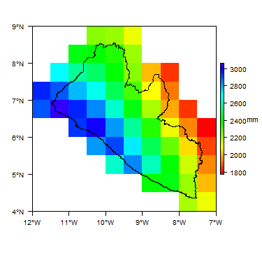 Average Annual Precipitation
 -
 Average Temperature


For further detail on the climate datasets used see the climate resources section.
Surface water
|
|
 |
Soil
 |
Land cover
 |
Geology
The geology map shows a simplified version of the geology at a national scale. More information is available in the report UN (1988) (see References section, below).
|
|
 |
Hydrogeology
The hydrogeology map below shows a simplified version of the type and productivity of the main aquifers at a national scale (see the Hydrogeology Map resource page for more details).
More information on the hydrogeology of Liberia is available in the report United Nations (1988) (see References section, below).


Groundwater management
Water point databases exist with information on more than 3,000 hand dug wells and more than 600 boreholes in Liberia, although information for some parts of the country is not yet recorded. Most of this information was collated during the 2011 Liberian Waterpoint mapping project. Most of the waterpoints recorded are groundwater sources - hand dug wells or boreholes, although only protected (improved) hand dug wells are recorded in the database. The waterpoint database does not contain much groundwater information: no geological log information is available for the groundwater sources, and most have no information on groundwater (rest/static) level. Some qualitative water quality information is available. The waterpoint database is available to view and download at the WASH Liberia website.
Transboundary aquifers
For further information about transboundary aquifers, please see the Transboundary aquifers resources page.
References
References with more information on the geology and hydrogeology of Liberia can be accessed through the Africa Groundwater Literature Archive.
United Nations. 1988. Groundwater in North and West Africa: Liberia. United Nations Department of Technical Cooperation for Development and Economic Commission for Africa.
Return to the index pages
Africa Groundwater Atlas >> Hydrogeology by country >> Hydrogeology of Liberia